I was lucky enough to spend ten days on of Grand Canary in April 2007. What is immediately apparent is the volcanic nature of the island, with exposures of basalt and other igneous rocks as well as craters and steep crags. Some of the landscapes, especially to the south of the central mountains, are reminiscent of the “badlands” of America.
The Canaries lie in the Trade Winds, and as a result the weather is very different on the two sides of the island: on the north it is often cloudy, with mist and rain not uncommon, and relatively equable temperatures; south of the mountains which block the damp air it is much drier, and hot. As a result the hills in the north, especially the north-east around San Mateo, are lush and green with a wide variety of wild flowers, but the south is semi-arid with scrubby vegetation and much more bare rock exposed; there are, however, oases with palm trees which have an almost African look about them. The palms are native, and used to be much more widespread. A third vegetation zone occurs in the high mountains where there is pine forest, much of re-planted in recent times, although at least some of the forest at Tamadaba above Agaete is a remnant of the original flora.
We stayed in two hotels, the Finca Las Longueras at Agaete in the NW of the island, and the Hotel Rural Las Calas near San Mateo in the NE.
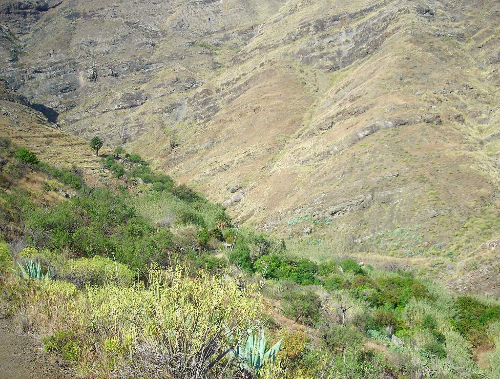
San Pedro is the top village in the Agaete valley, a good place to start walking... we did a 7½-hour circuit from here.
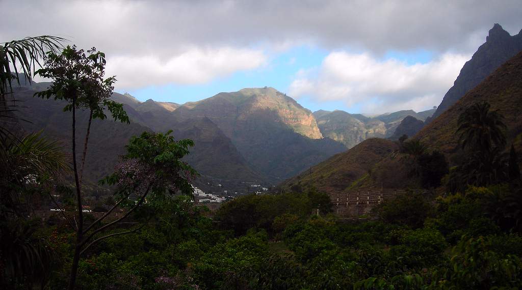
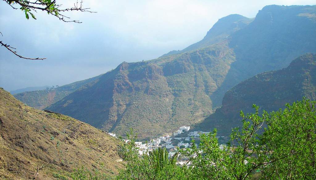
| Agaete view from hotel. The Agaete valley is a spectacular, deep, ravine-like gorge running down north-westwards from the Tamadaba mountains. | |
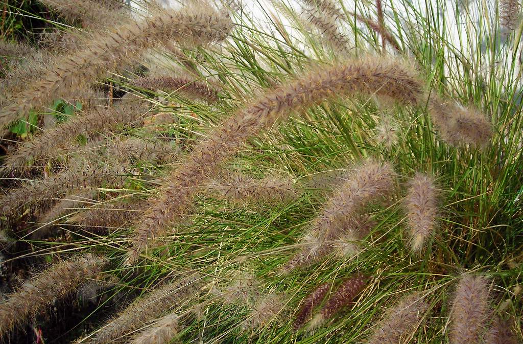
| Catstail grass. An invader from Africa, this is very common now along track-sides | |
| Above San Pedro. | |
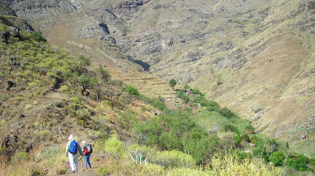
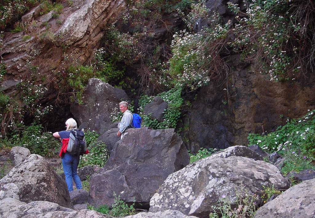
| Linda and Armando above San Pedro. Starting the long climb up from San Pedro to Tamadaba (it got steeper further up). | |
| Village in Agaete valley. Looking back down into the valley. | |
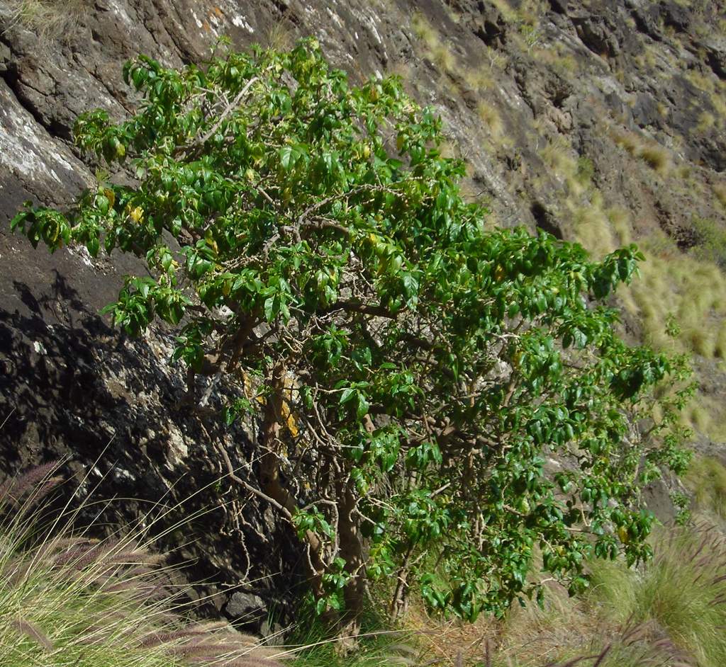
| Native bush. Our guide Armando pointed out this native, endemic bush, but I did not catch its name. | |
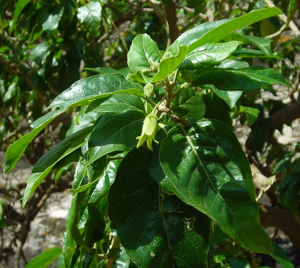
| Native bush detail. | |
| Green hollow. A kind of damp grotto in the hillside above San Pedro. | |
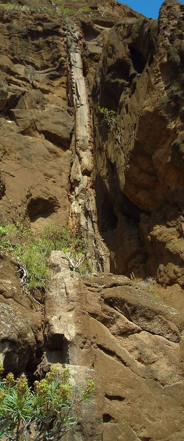
| Dyke. A classic volcanic dyke cutting through the “country rock”. A dyke represents a feeder pipe for lava which has solidified within a crack formed in the existing rocks. | |
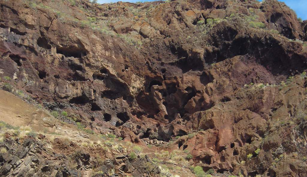
| Guanche caves. The Guanche were the original inhabitants of the Canaries before the Spanish arrived in the 15th century. They were cave-dwellers, and this collection of caves cut into the soft volcanic rock was one of their larger villages. | |
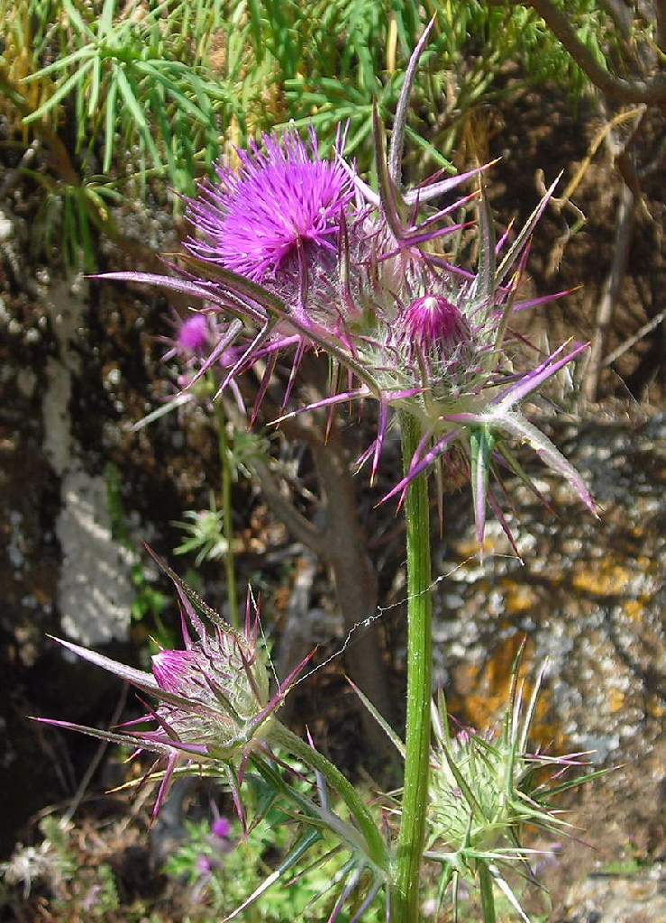
| Galactites. A very attractive thistle relative. | |
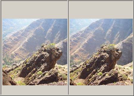
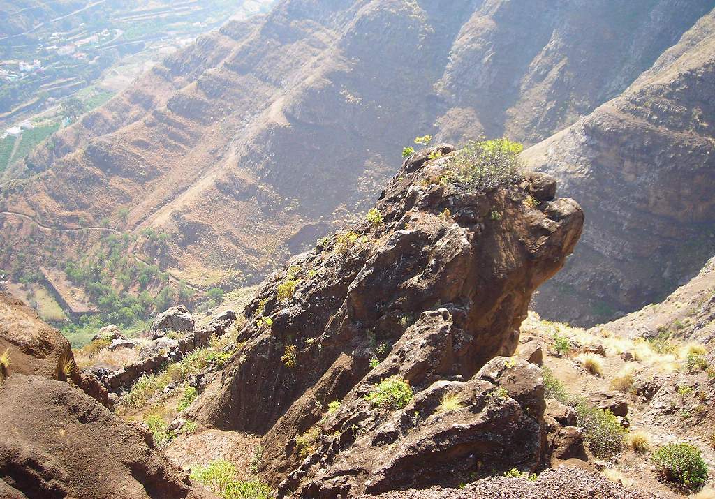
| Lion rock. One of the many extraordinary rock formations, this reminded me of a crouching lion or sphinx. I suppose it would be about ten foot tall. Stereo view below |
|
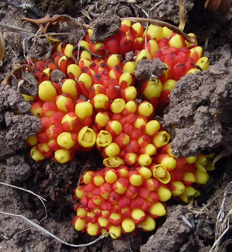
| Cytinus. Probably Cytinus hypocistis. A curious little plant, parasitic on the roots of Cistus bushes. It has no leaves, but produces these stunning flowers apparently from nothing on the bare, dry soil. The individual flowers are maybe a third of an inch (8mm) across. | |
| Agaete valley. A view back down the Agaete valley from near the top. | |
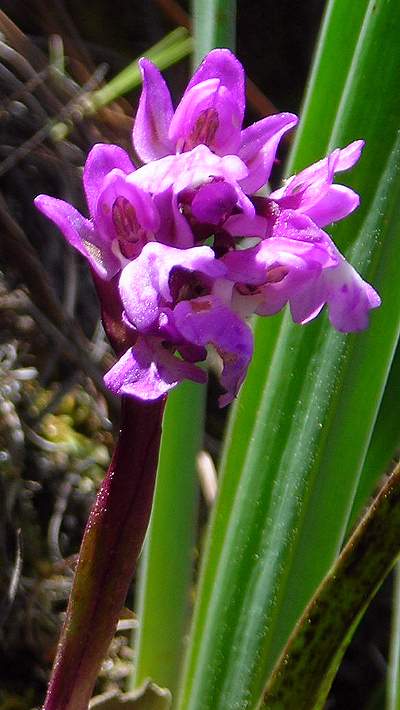
| Small orchid. Rather surprisingly the only orchid I saw. | |
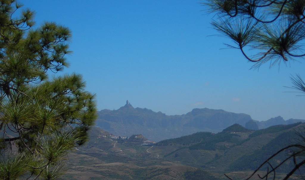
| Roque Nublo through pines. A distant view of the curiously shaped Roque Nublo (Cloud Rock), seen through the forest of native Canary pines. | |
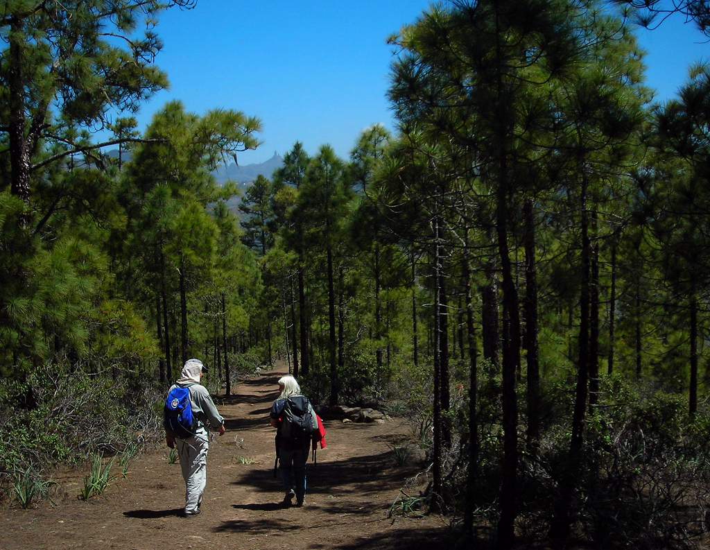
| Tamadaba pines. Walking through the protected Tamadaba pine forest on the plateau above the Agaete valley. | |
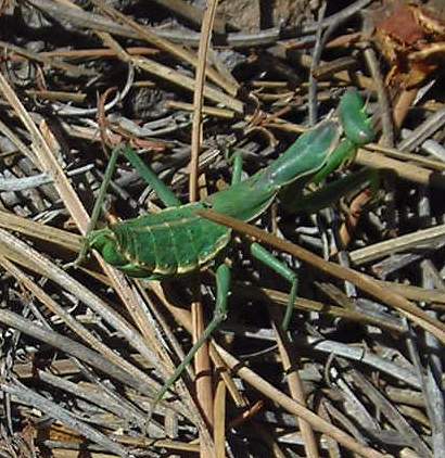
| Mantis. This little green mantis, maybe 1½in long, was on the path in the pine forest. It was the only one I saw. | |
| Reservoir above El Hornillo. One of the many reservoirs on Grand Canary, which apparently don’t appear on the other islands in the group. | |
| Columnar basalt. A particularly fine example. The columns are formed as hot, liquid basalt cools and solidifies, although the exact mechanism is not fully understood. | |
| Agaete chapel. The hotel is a converted country house which has its own private chapel. It was very dark inside and this was the best picture I could get. The light you can just see at the top was a very ornamental silver chandelier, similar to (though obviously smaller than) those in other churches on the island. | 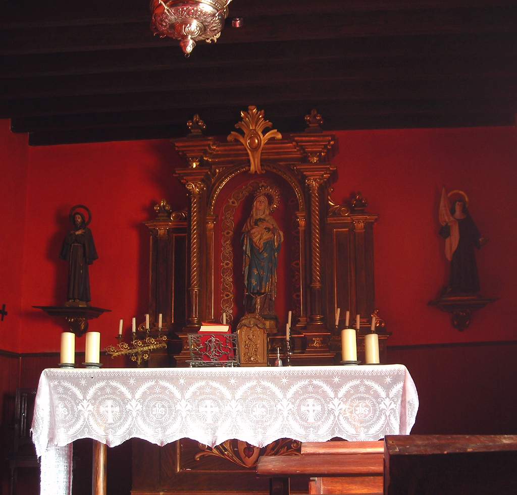 |
| Agaete hotel. The front courtyard of the hotel. The massive tree on the left was some kind of laurel, and home to a pair of turtle doves. | 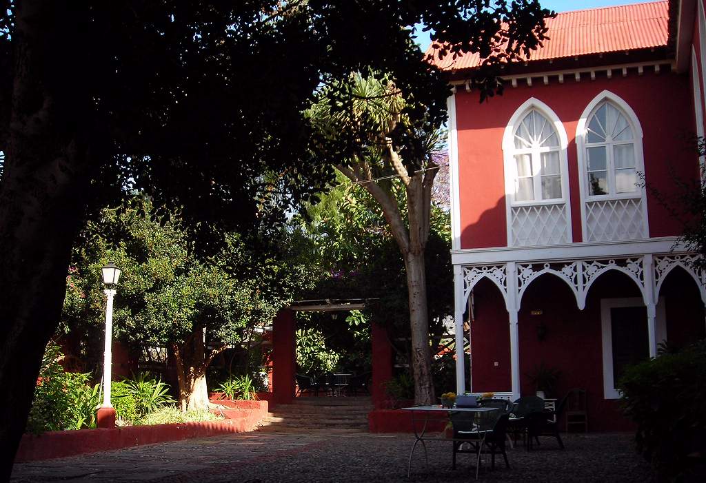 |
| Agaete church. The main church in the middle of Agaete, which is a bustling small town. | 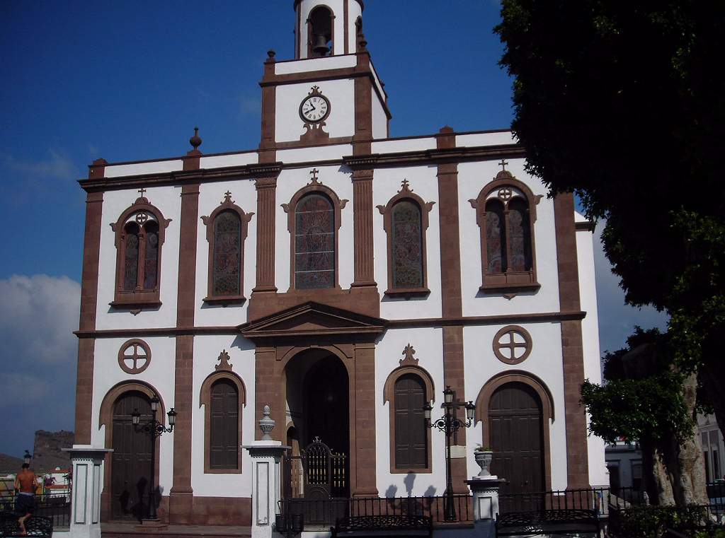 |
| Agaete square. The square in front of the church. Note the white pattern laid in the paving stones. | 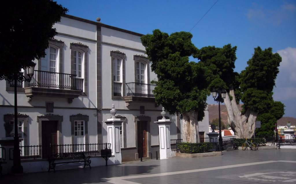 |
| Agaete square detail. Detail of the paving in the square. | 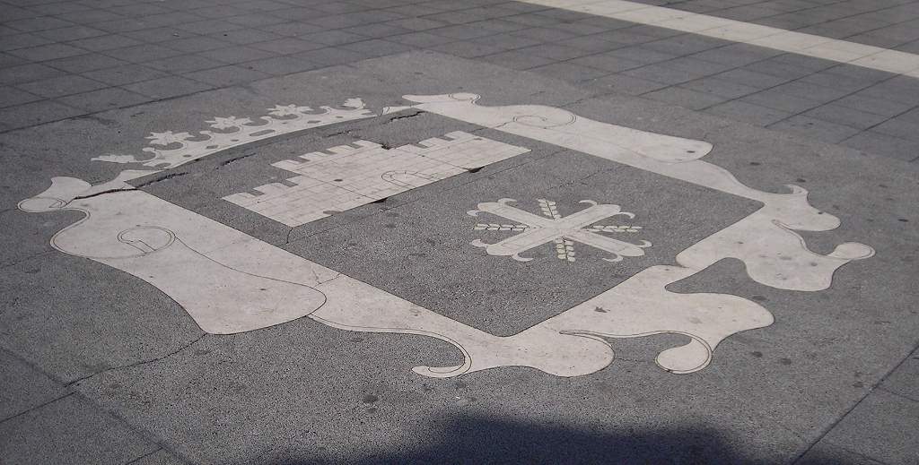 |
| Carving in Agaete shop. This was on the front of the counter in the local pharmacy where we stopped to buy some sun cream. | 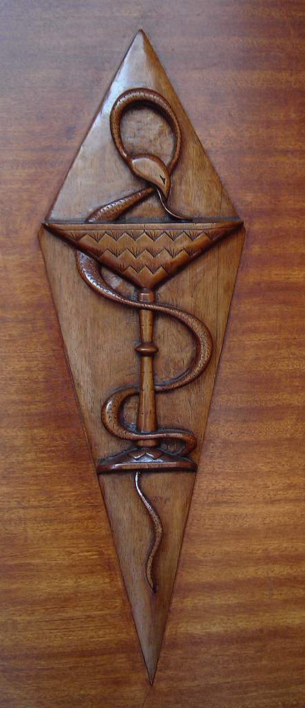 |
| Agaete port. The port is a mile or so from the centre of town and is a busy area with restaurants serving the locally caught fish. The ferry to Tenerife docks here. The sea stack in the right foreground is known as the Dedo de Dios (Finger of God). Old pictures show it with a much more obvious finger of rock at the top – I am not sure what interpretation is to be put on the breaking of God’s finger... | 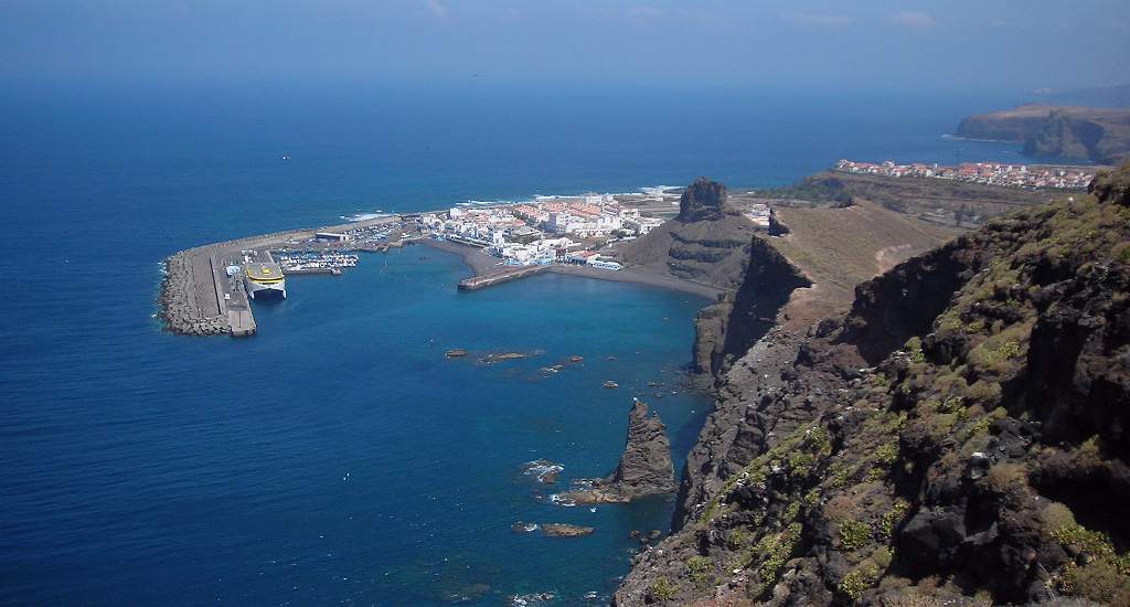 |
| Coastal rocks at Guayedra. Just a little to the south of Agaete. The stretch of coast from here down towards San Nicolas is very spectacular, with a fantastic corniche road running along the cliffs for the brave driver to enjoy, complete with overhangs, sheer cliffs and hairpin bends on which you are quite likely to meet a bus. | 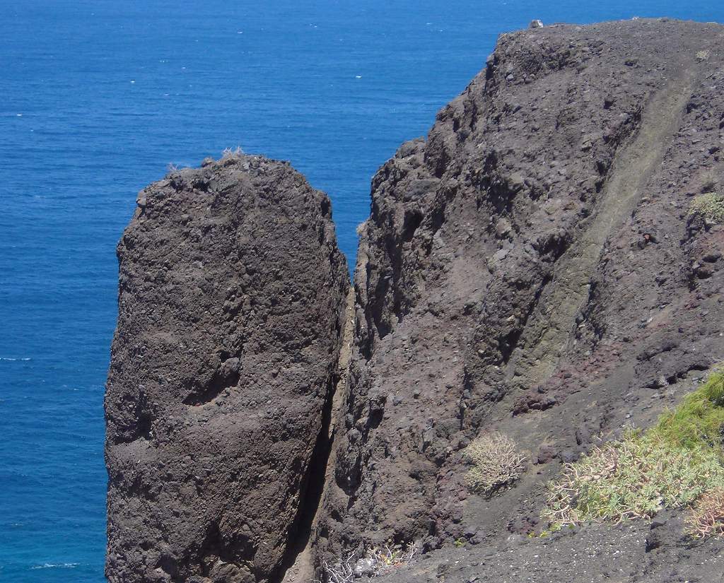 |
| Guayedra beach. A local beauty spot, but only reached after a steep scramble down the hillside. | 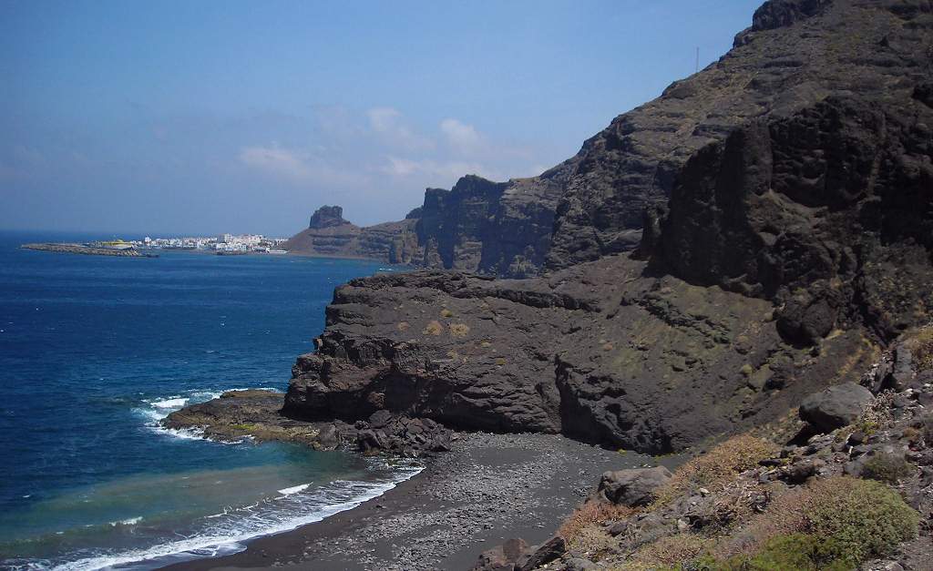 |
| Near Guayedra beach. | |
| Tenerife ferry leaving. Having just left Agaete port. | 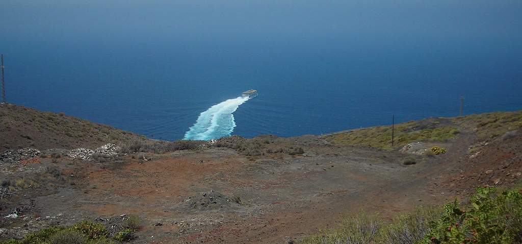 |
| Threshing floor. These roughly circular paved areas surrounded by low walls were used as threshing floors. As here they were often placed at a col, possibly because there is likely to be a good breeze here to blow away the chaff, leaving the heavier grains on the stone floor. This particular floor was also a good marker on the walk, as the path back down to Agaete left from here – otherwise it would not have been easy to find. | 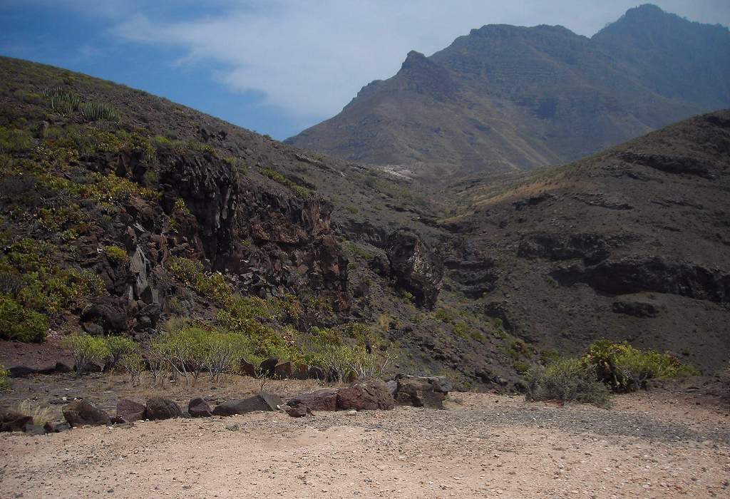 |
| Spurge on hillside. The little valley leading down from the threshing floor had an unusual flora, with many of these candelabra spurges along with small shrubs such as cistus. | 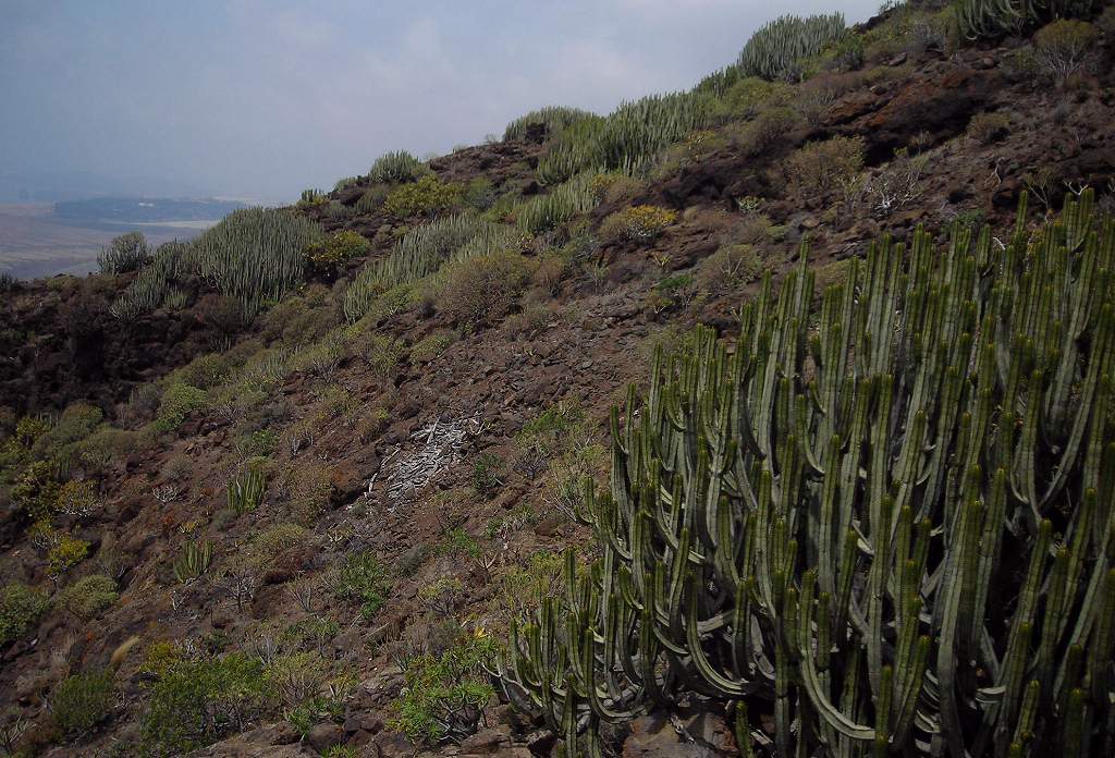 |
Sometimes it rains! Teror is in the north of the island up in the hills away from the coast. It is said to be the prettiest small town on the island, and is built around the cathedral containing the famous Virgin of the Pines. The old bishop’s palace is now a museum. On our way we went to the mirador or viewpoint for the Bandama crater.
| Bandama crater. A perfect volcanic cone with a deep crater. There is a single farm at the bottom where the land is very lush adn the climate sheltered. It is a very steep way down, which we did not attempt – likewise the walk around the perimeter of the cone. There was a brief glimpse of sunshine here before the clouds closed in again. | 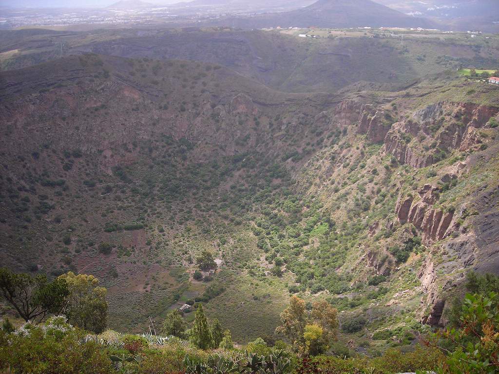 |
| Teror cathedral. | 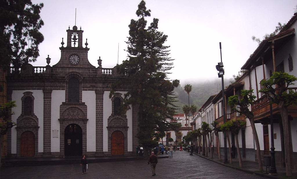 |
| Teror square. |  |
| Teror street. | 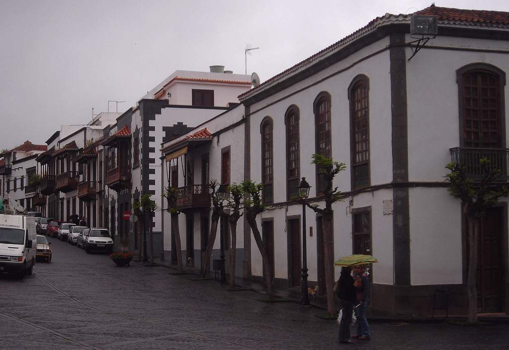 |
| Teror tree. | 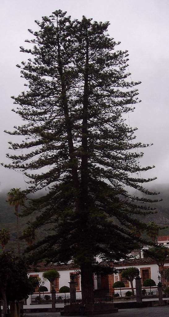 |
| Teror Virgin. | 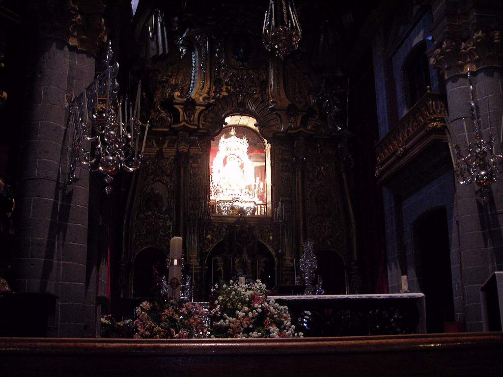 |
| Las Palmas street. A typical street in the old quarter of the capital, Las Palmas. | 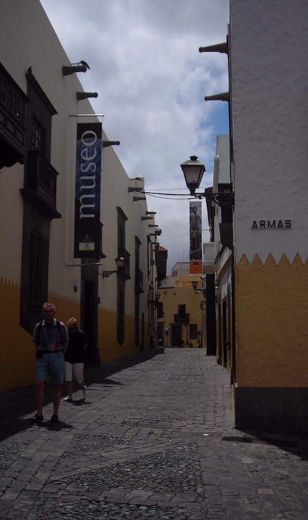 |
| Las Palmas old church. This was the original church in Las Palmas, built by early Spanish settlers before the cathedral. | 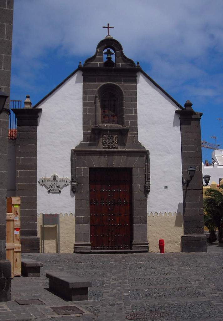 |
| Las Palmas cathedral courtyard. |  |
| Las Palmas cathedral. | 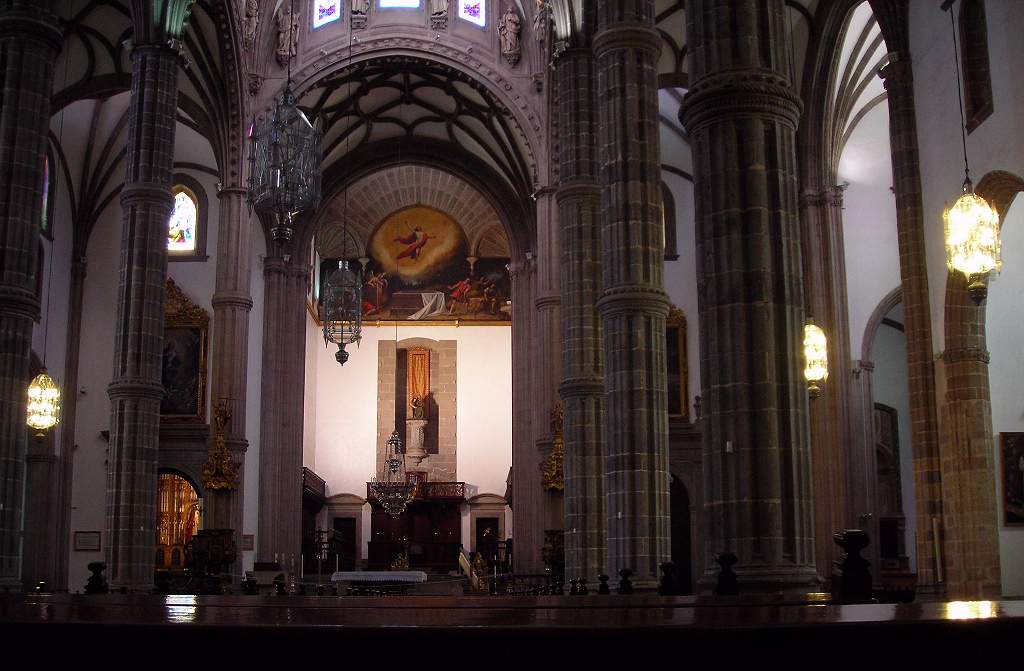 |
| Las Palmas cathedral crossing. | 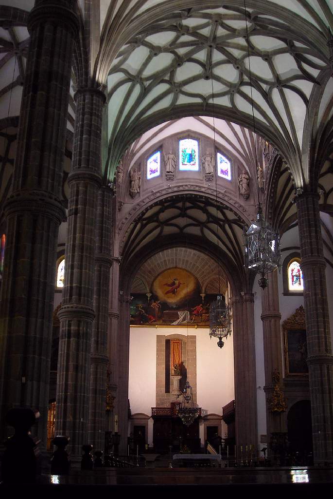 |
| Las Palmas cathedral ceiling. | 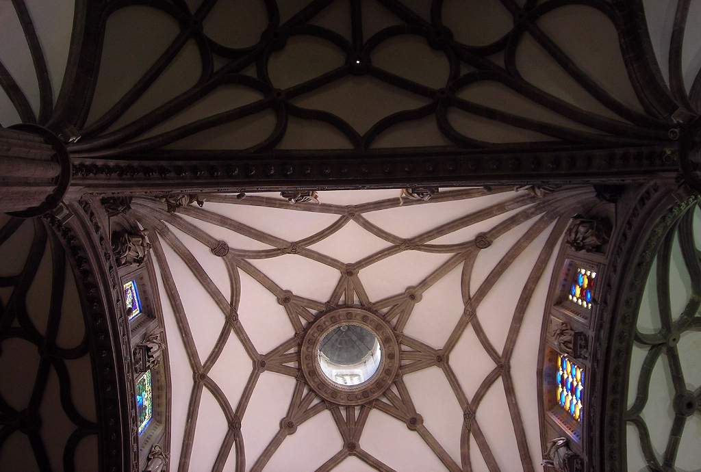 |
| Las Palmas cathedral altarpiece. | 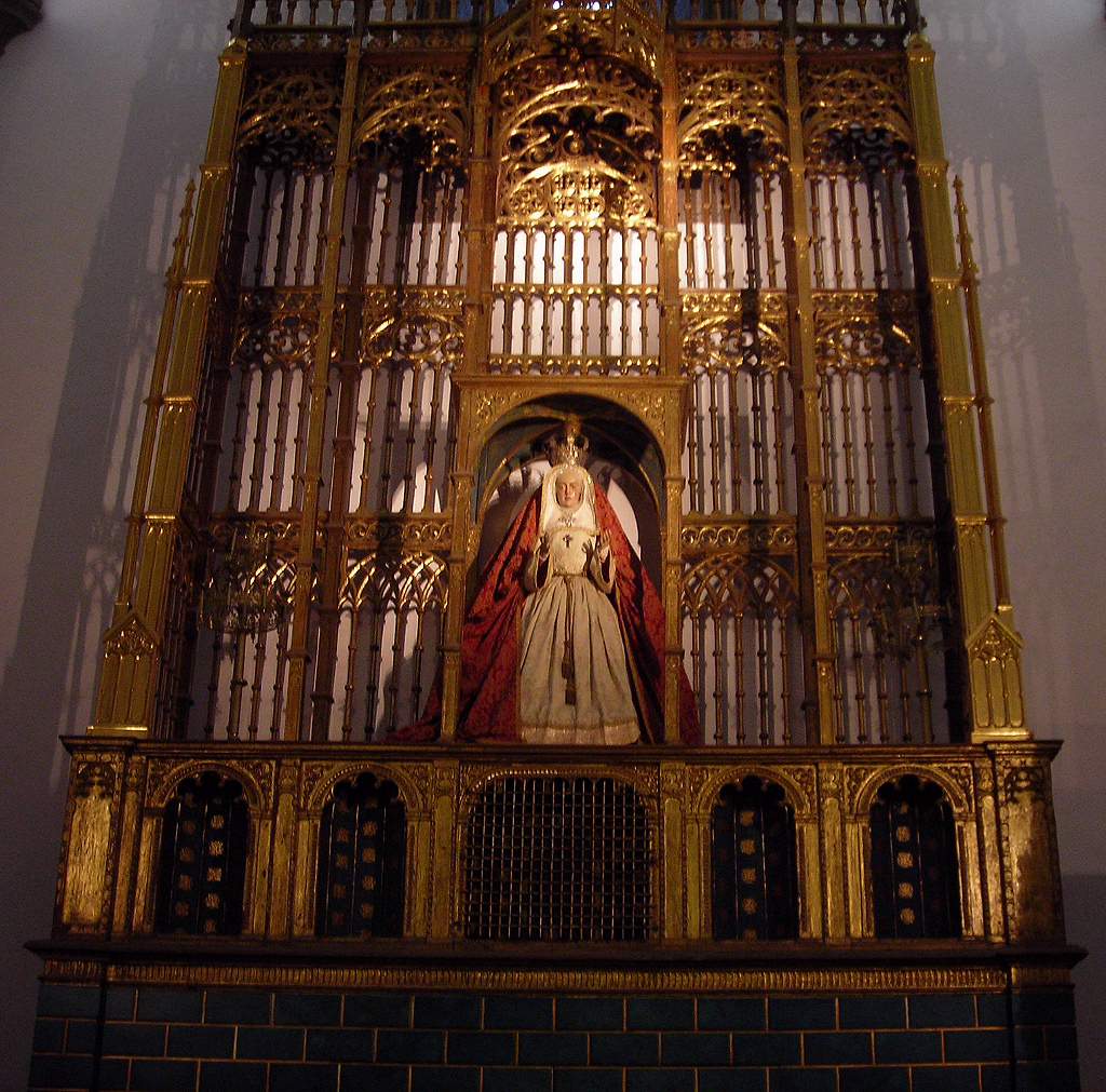 |
| Las Palmas cathedral tiled floor. Upstairs in part of the cathedral complex around the courtyard. I think this room was the treasury. | 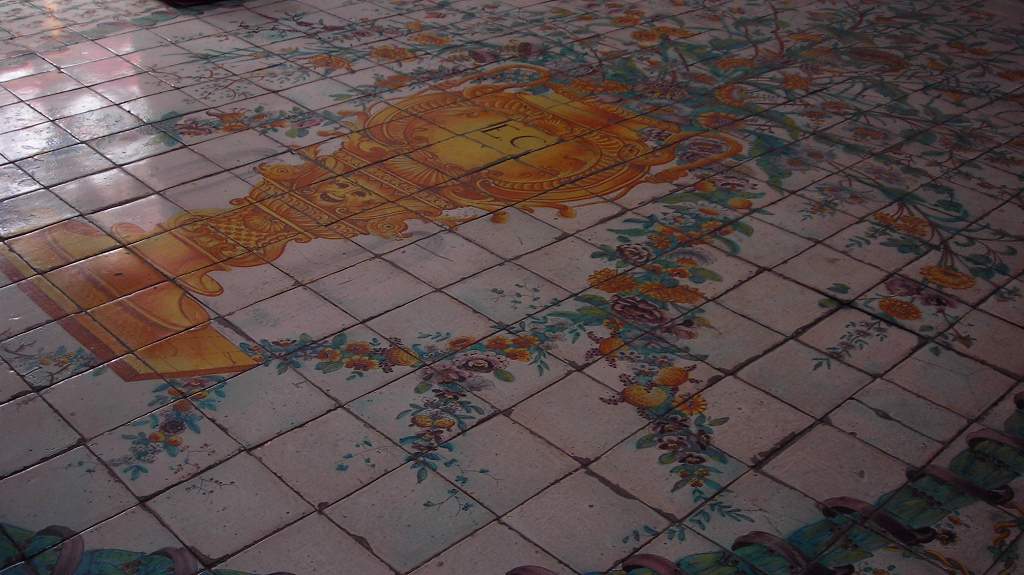 |
Columbus House courtyard. Probably not actually Columbus’s house, but he might have visited it. In any case, a fine example of a rich merchant’s house, now a museum |
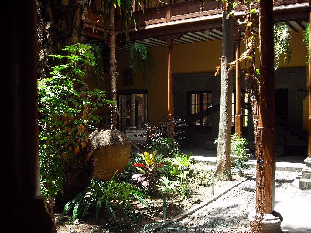 |
| Columbus House well. | 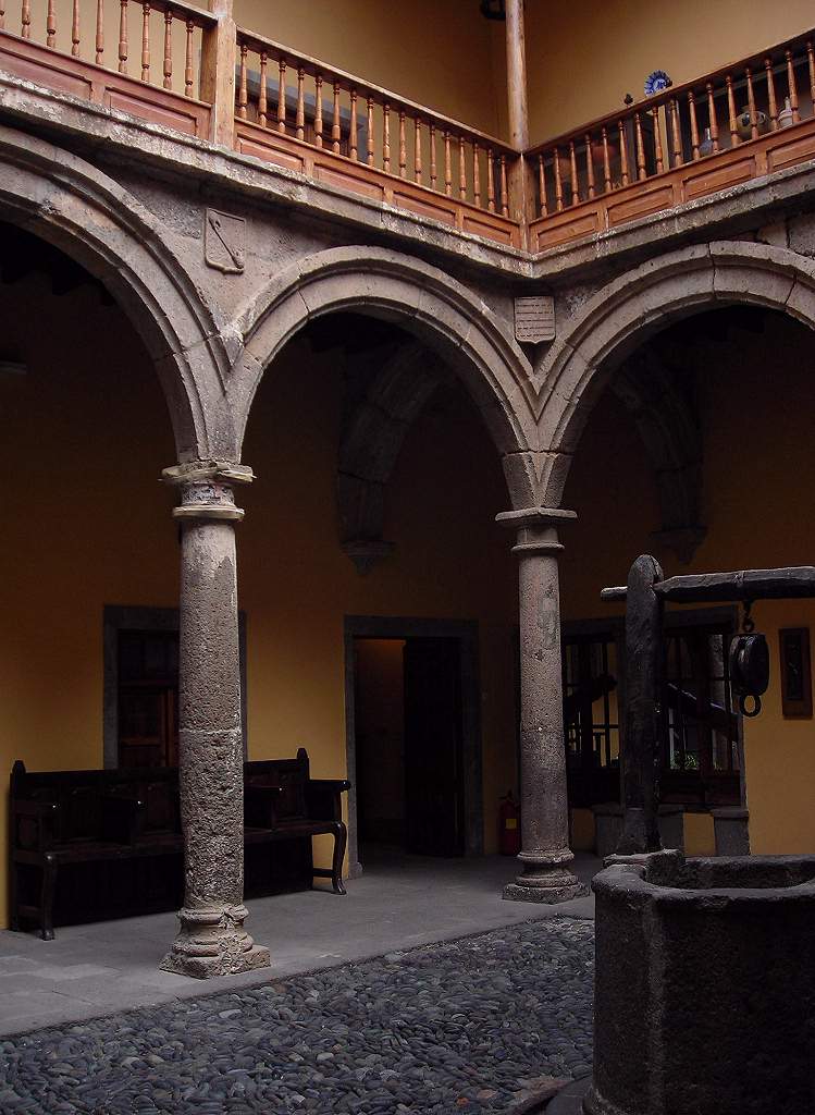 |
| Columbus House window. | 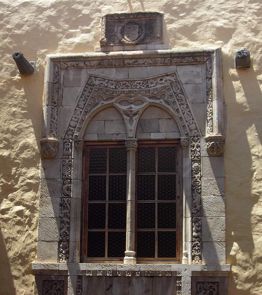 |
| Wood sculpture. In the courtyard of the Columbus House. | 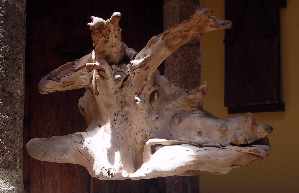 |
| Las Palmas street name. In decorative tiles, as many of them are. | 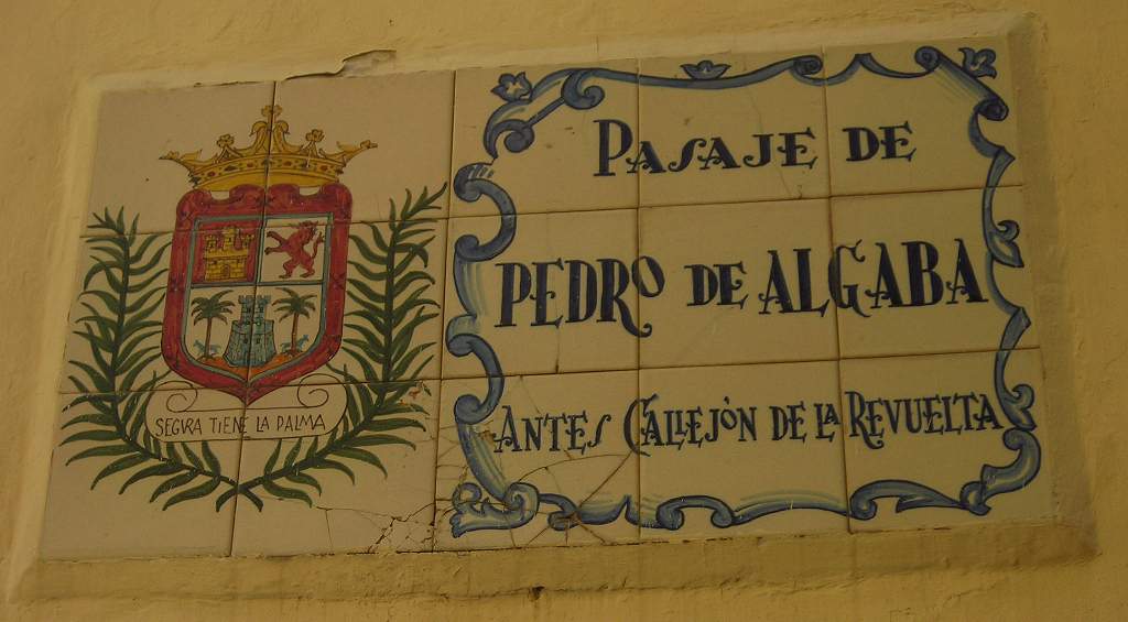 |
Botanic gardens. The Botanic Gardens are outside the city, on both sides of a steep ravine or “barranco”. One could easily spend half a day, or even a whole day, exploring them, but e did not have enough time to spare. Entry is free, nad the various paths are well signposted. | 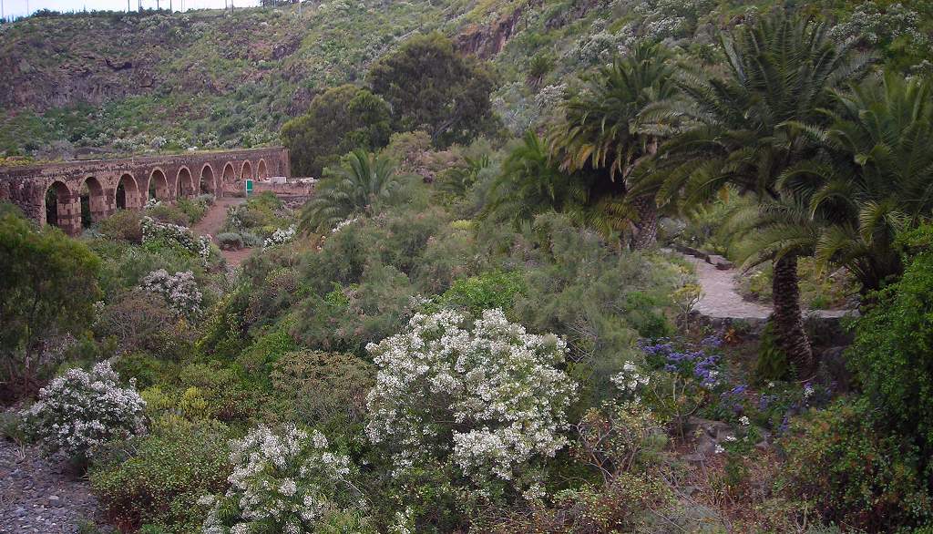 |
| Botanic gardens unknown flower. | 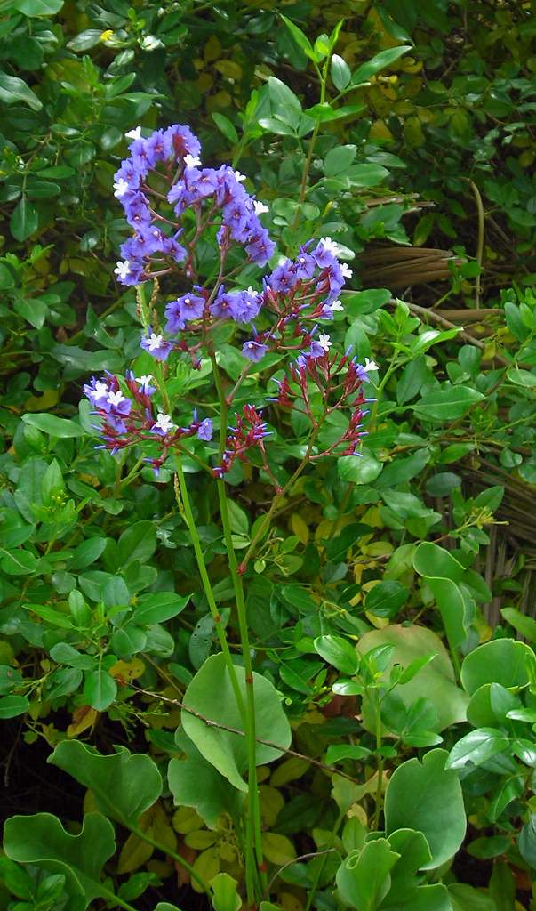 |
| Giant spurge (Euphorbia). | 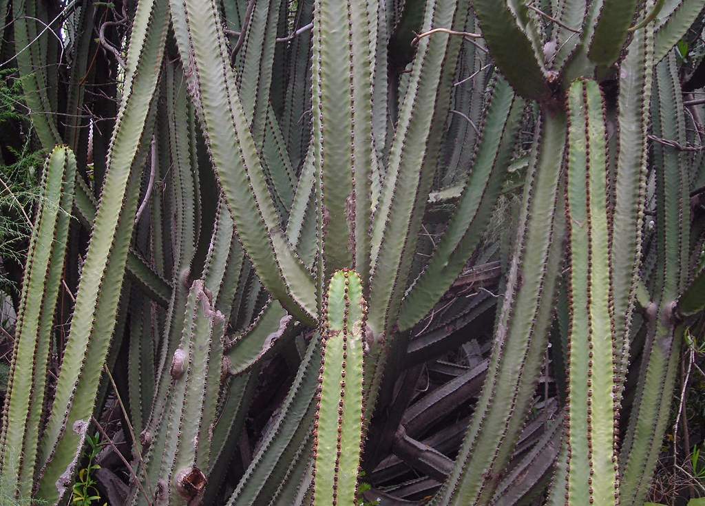 |
| Strange rock plants. | 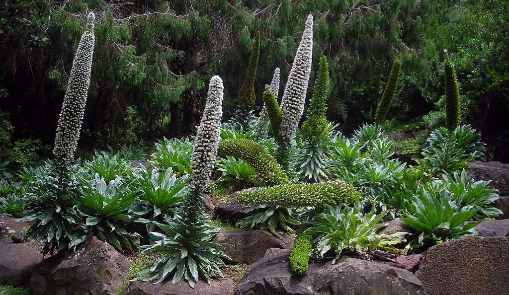 |
| Botanic gardens with buildings. | 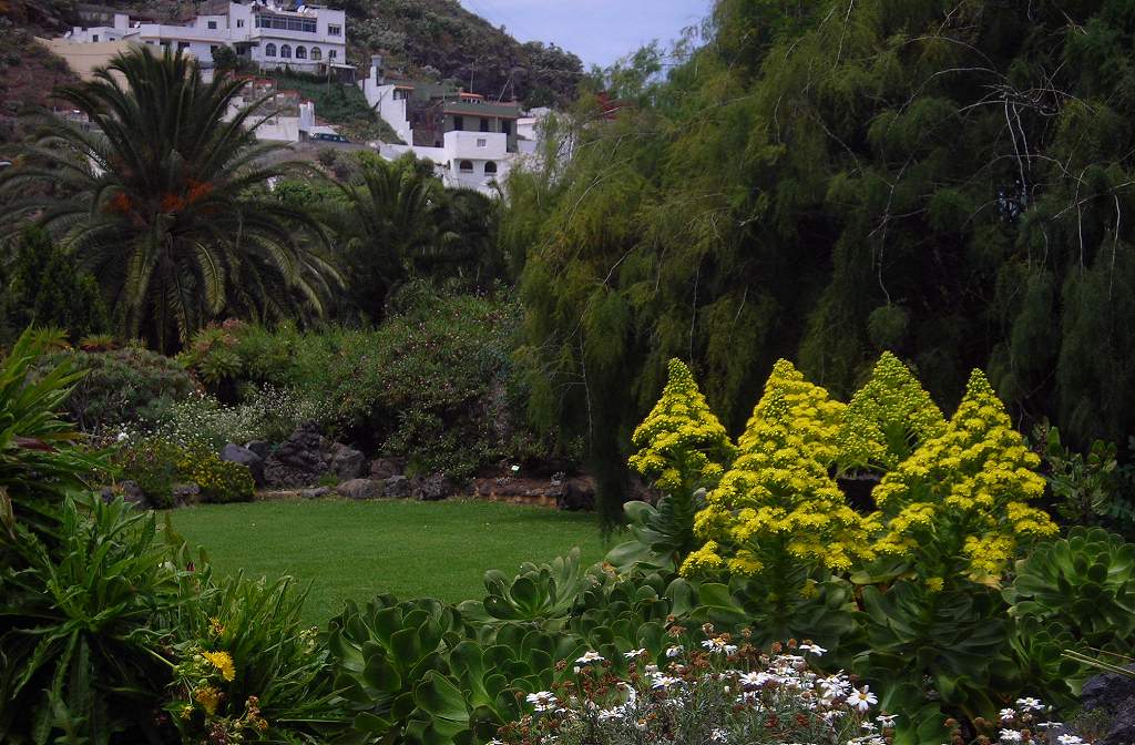 |
| Giant cactus. This was the trunk of a giant tree cactus at least 20ft tall in the hotel gardens. | 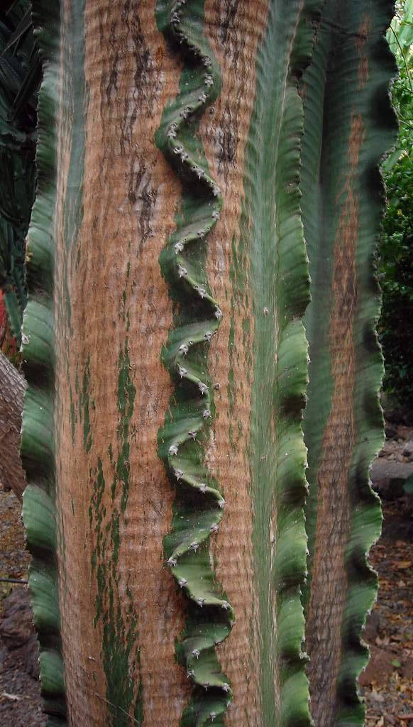 |
| Pool at Agaete hotel. | 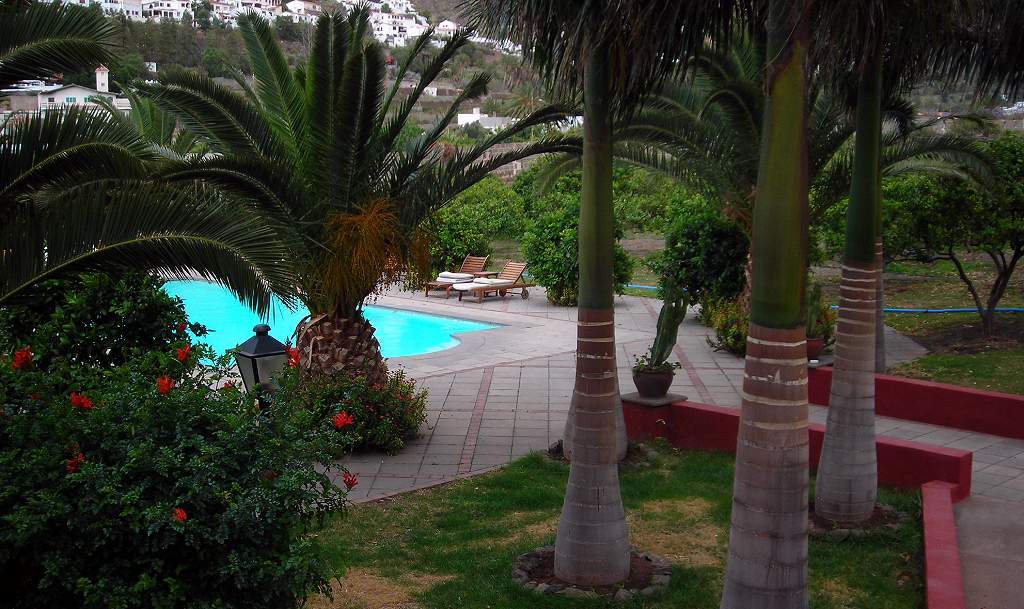 |
| Avocado flowers. Growing in an orchard behind the hotel. | 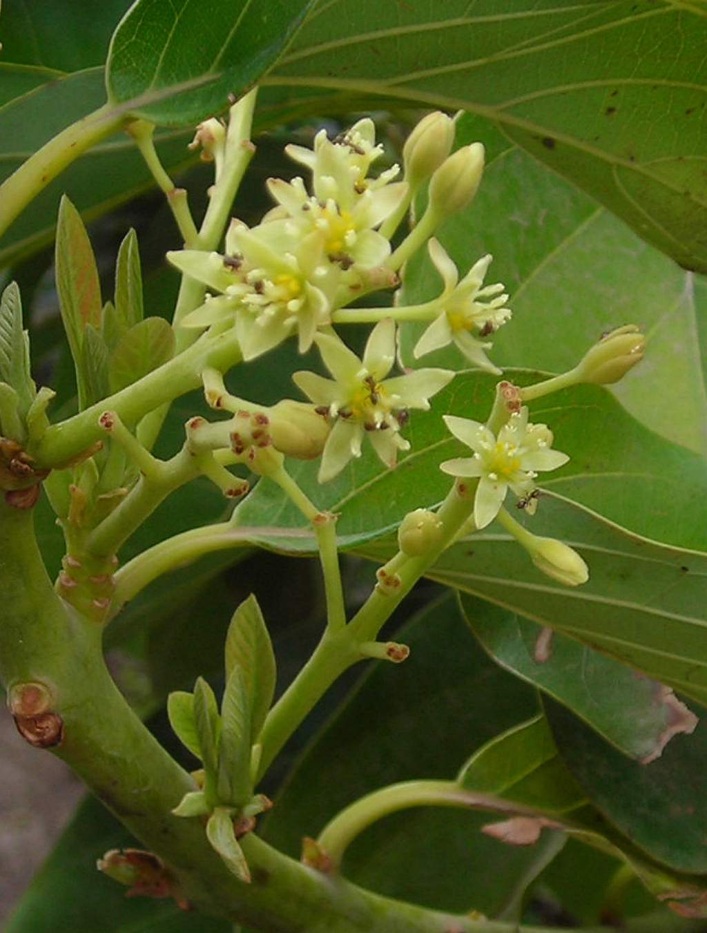 |
| Agaete hotel across valley. I went for a gentle stroll up the valley side opposite the hotel, up to a radio /microwave mast. | 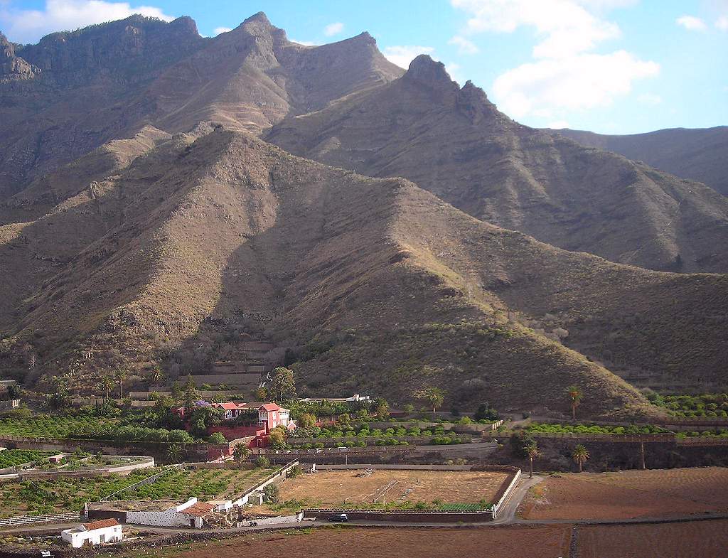 |
| Prickly pears. These are common all over the island. | 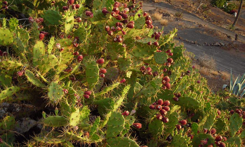 |
| Basalt cliffs. |  |
| Cactus spurge. ...or Candelabra spurge – also very common on slopes especially the northern and central parts of the island. | 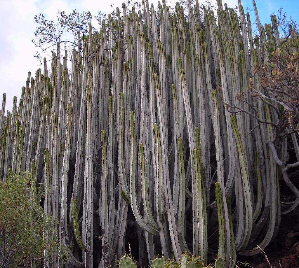 |
| Evening view of Agaete valley. | 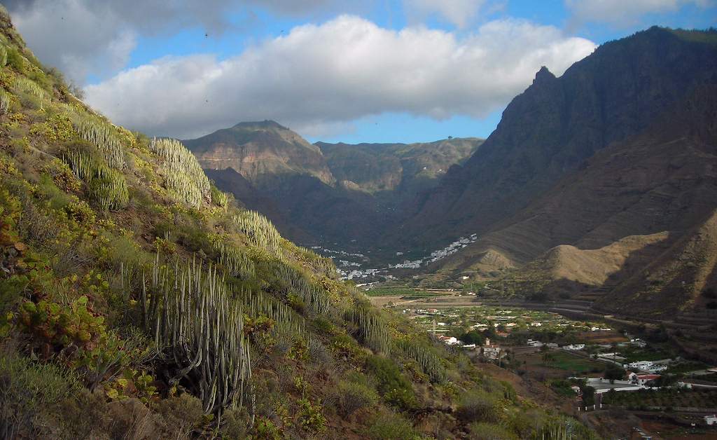 |
| Galactites with hoverfly. | 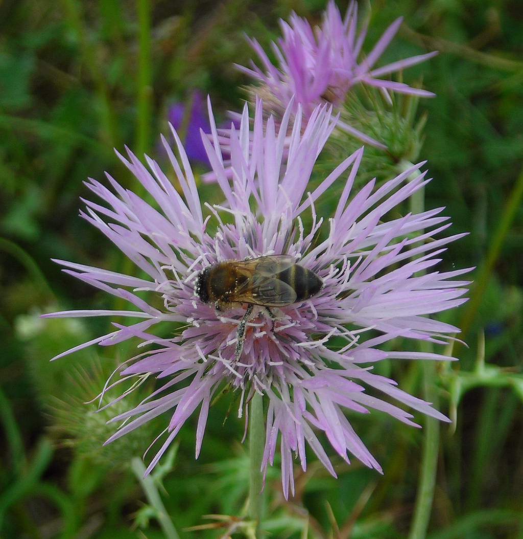 |
| Palms near Agaete. It seemed incongruous to have palms growing in this very rugged, rocky landscape, but they are a native Canaries species. | 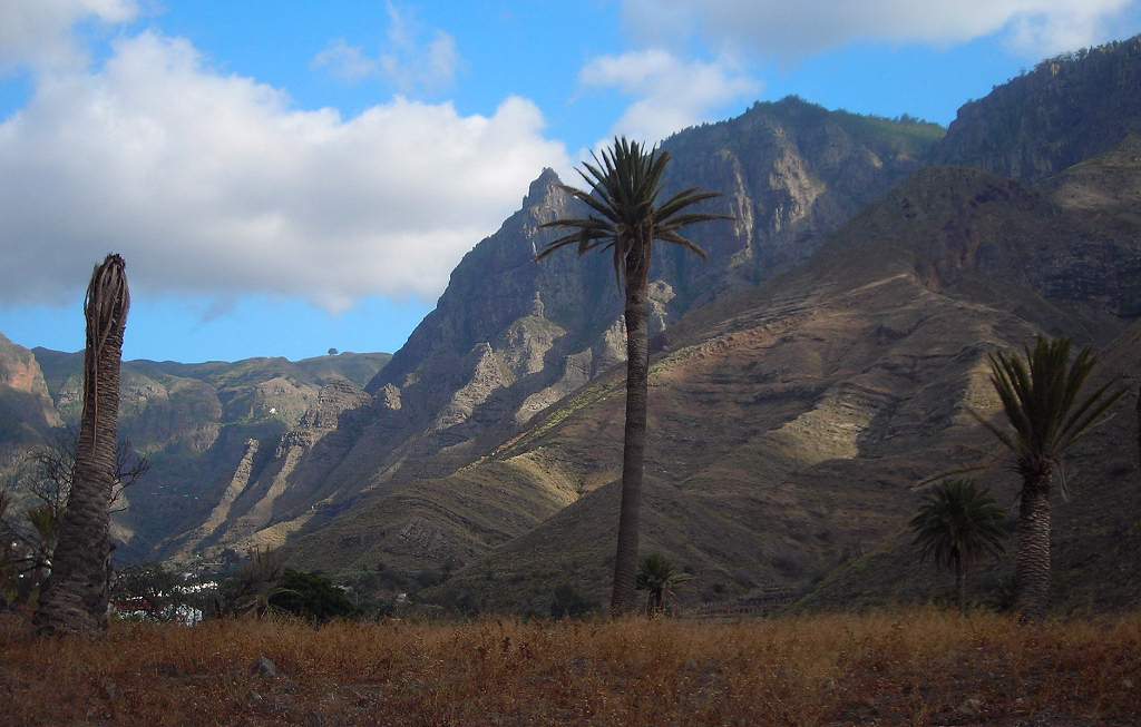 |
| Unknown tree Agaete. I have no idea what this was: the tree was roughly the shape and size of a larch, growing on the roadside. |  |
This was an aborted walk to the Pico Viento (Windy Peak), as the top was in the clouds. As you can see from the ruffled fleece of the sheep the peak was living up to its name.
| Sheep above Hoya La Pineda. | 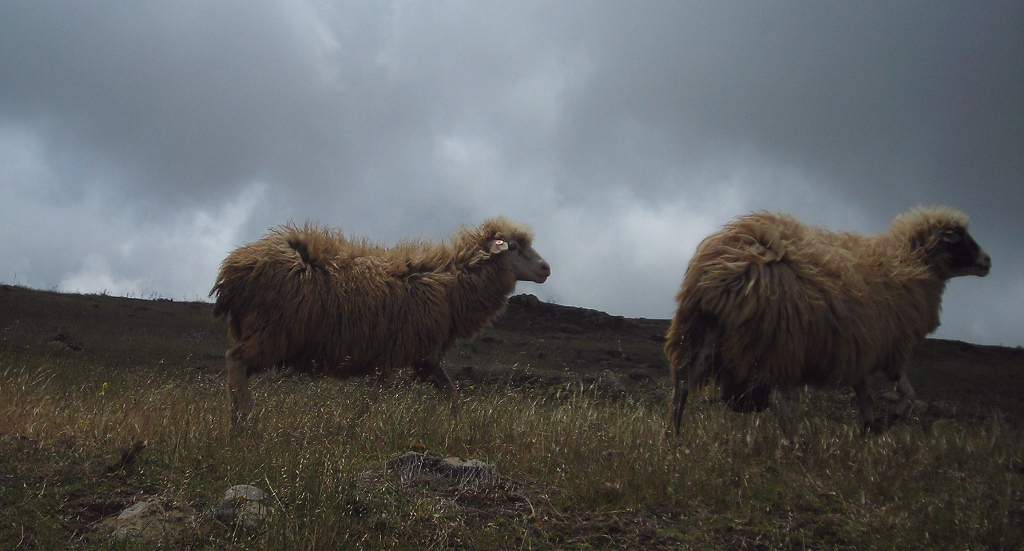 |
| Hoya La Pineda Bar. This bar was actually a cave-house, cut into the rock at the back. Hoya la Pineda is a tiny village with this bar, one shop and a handful of houses. |  |
| Flowery meadow near Pico Viento. (This picture was actually taken on a different day.) | 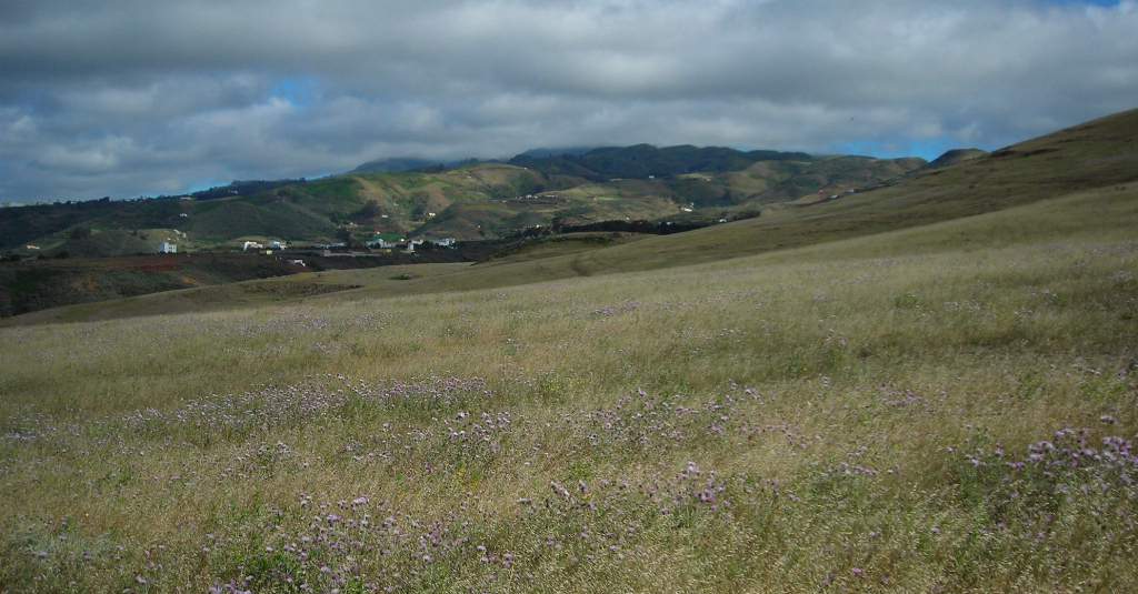 |
After a few days at Agaete we moved to the Hotel Las Calas near San Mateo, much closer to Las Palmas, and well set for exploring the mountains in the centre of the island. One of the circuits we walked was around the reservoirs of Chira and Soria, starting at Los Cercades.
| View of Roque Nublo. The Roque Nublo seen from the roadside. This “Cloudy Rock” is almost the highest point on the island, and visible from many places. It was held sacred by the Guanche. Despite its name it usually seemed to be clear of clouds most of the time. | 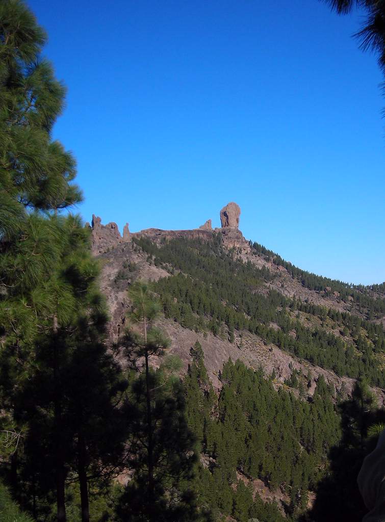 |
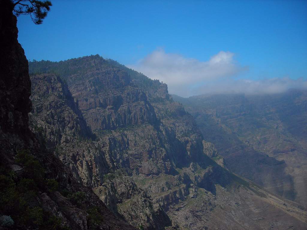
| Mountain view. This shows the edge of the sheet of cloud that can blanket the north of the island. The wind is from right to left, and the cloud shreds away as the airstream comes over the mountains into the “rain shadow”. Driving through it the boundary was astonishingly sharp: one ran from thick fog to clear sunshine in about 20 yards. | 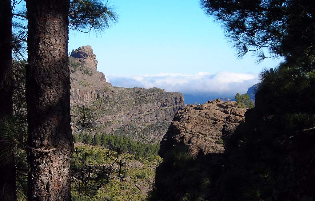 |
| Chapel at Los Cercades. This little white chapel was typical of many on the island. | 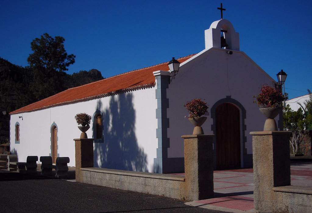 |
| Chira reservoir. | 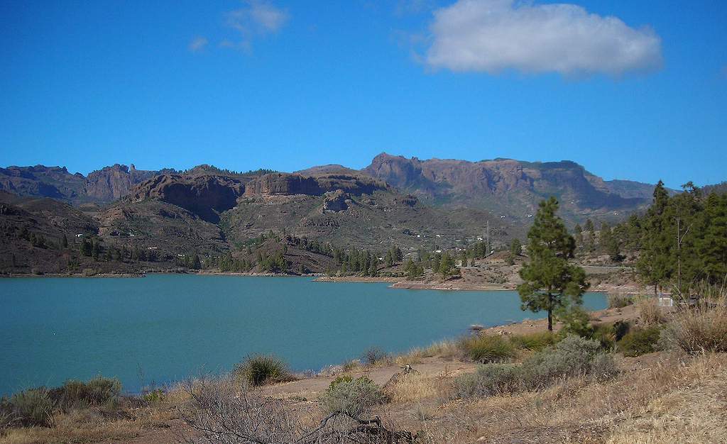 |
| Chira reservoir from above. Note the agave plant in the right foreground. | 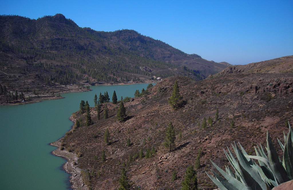 |
| Between Soria and Chira. | 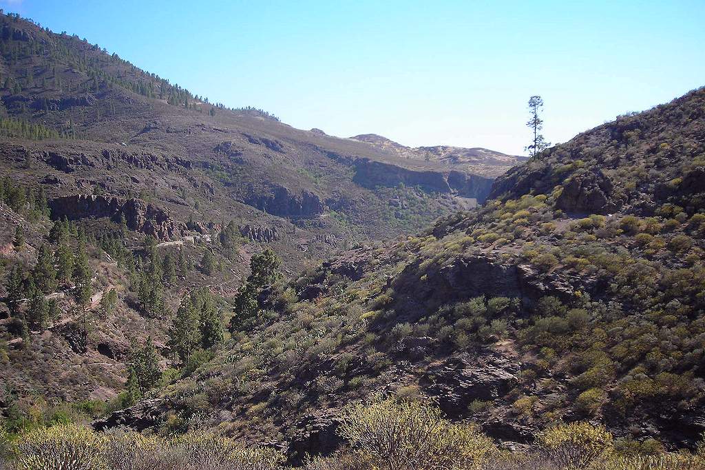 |
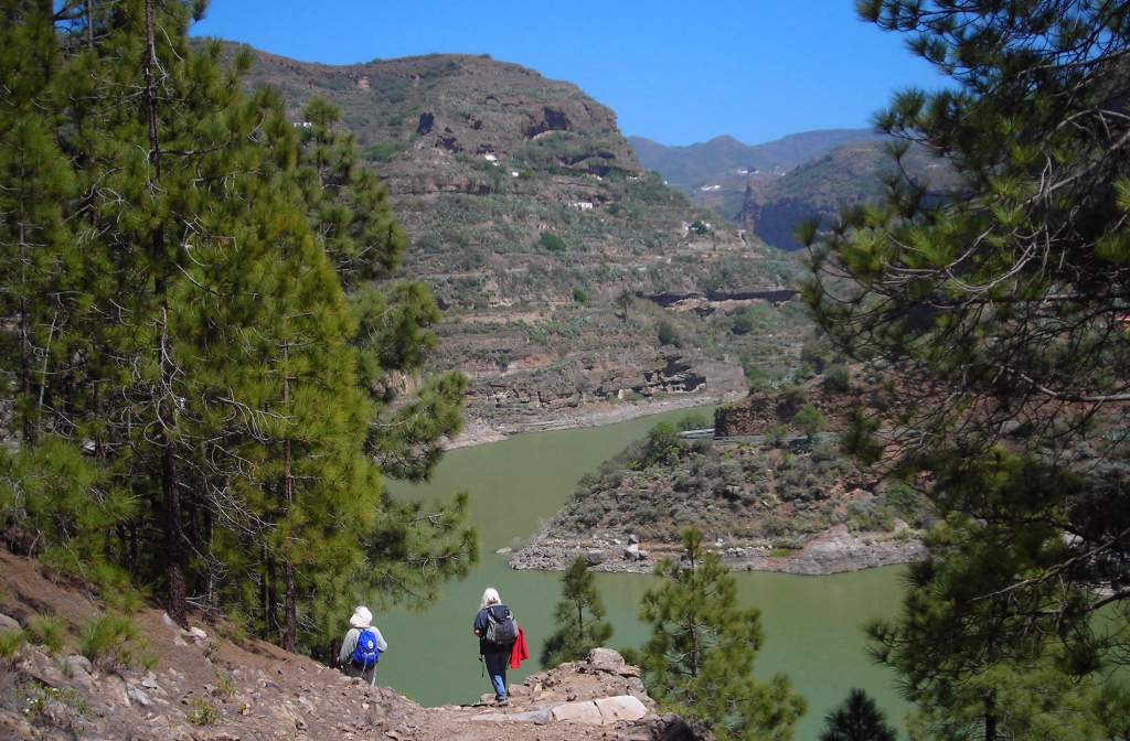
| View down to Soria lake. The reservoir at Soria lies well below that of Chira, and the climb down to it is very steep and somewhat of a challenge, especially as the path is not very clearly marked, and in places passes over scree slopes and loose gravel. And then one has to climb back up again! | 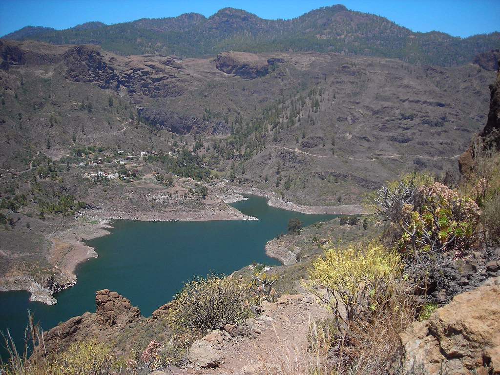 |
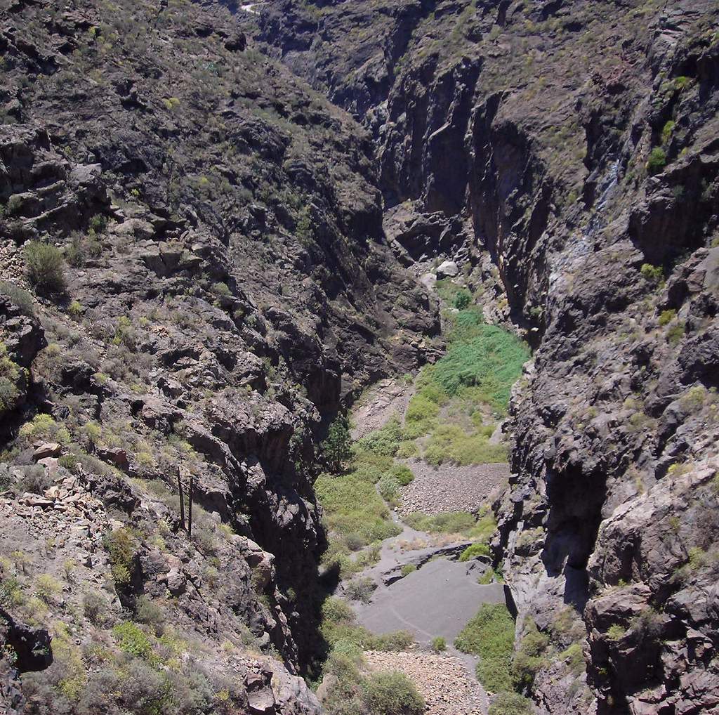
Ravine below Soria dam. This was a spectacular gorge, deep (maybe 300ft) with vertical sides. There was an old picture in a local bar of the waterfall that existed here before the dam was built in the fifties, and it was very high. Not surprisingly this is the deepest dam on Grand Canary. Some idea of the proportions can be gained from this stereo pair, tajen from the top of the dam.: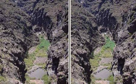
|
 |
| Soria lake from dam. The view looking the other way. | 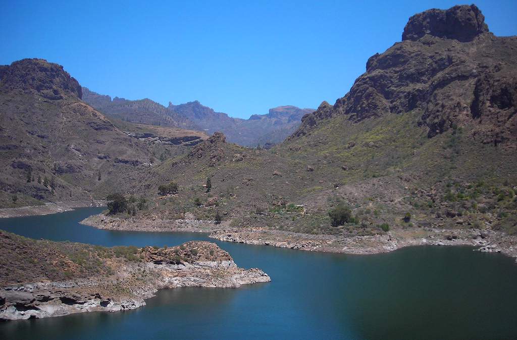 |
| Prickly pear flower. One of the two colour forms; the other is primrose yellow. | 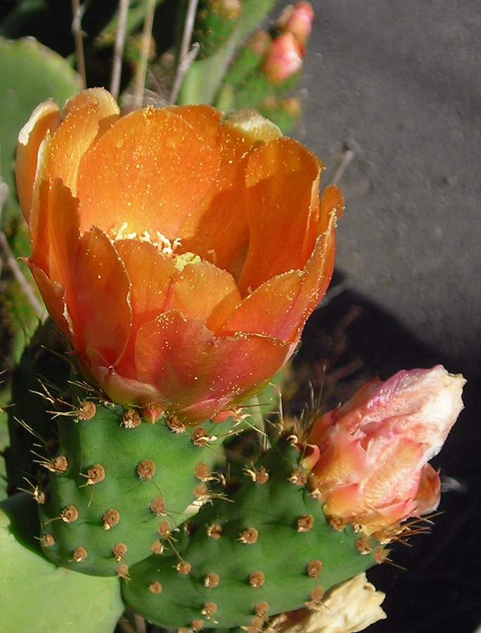 |
| Clouds near Roque Nublo. Another view of the clouds blanketing the north of the island. | 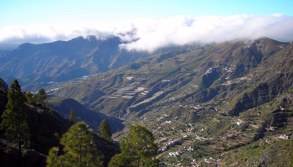 |
| Radar dome. The highest point of the island, but less spectacular as a landform than the Roque Nublo. There is a road up to the radar station but not open to the public. | 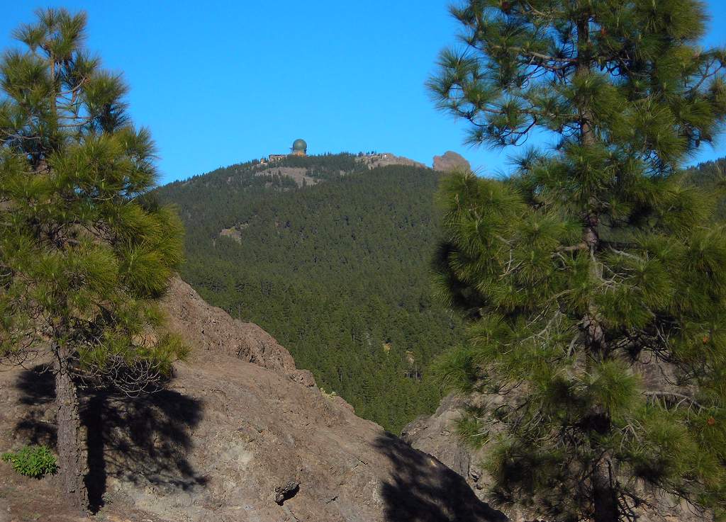 |
| Las Calas hotel. Part of the hotel gardens. | 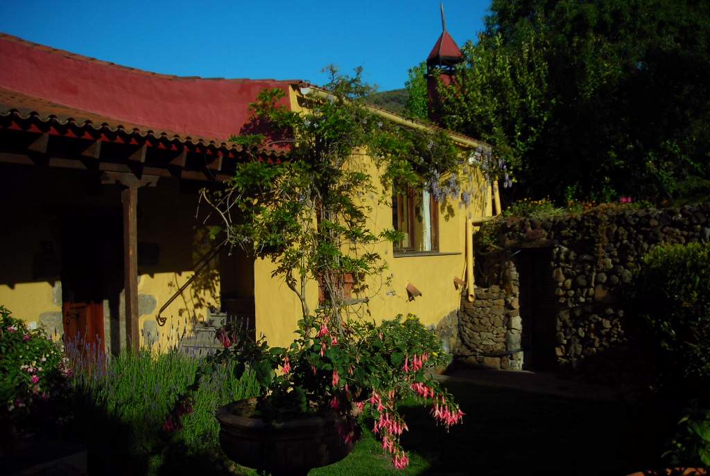 |
Another full day’s walk, a circuit from the small town of San Bartolome in the centre of the island, following in part the old camino real or royal road, one of a network of cobbled trails that pre-dated the modern road system.
| San Bartolome. | 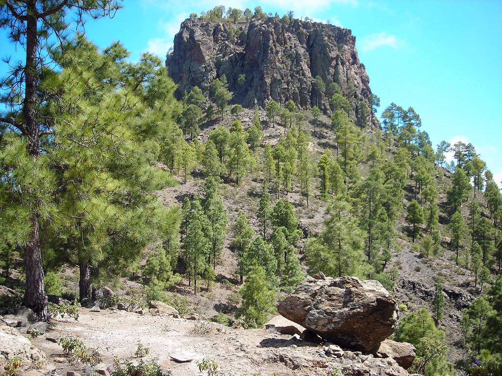 |
| Big stonecrop plant. One of many interesting plants seen on this walk. | 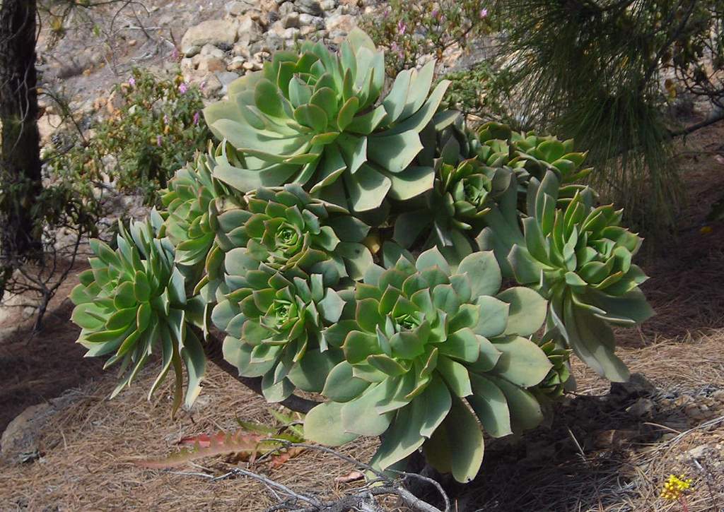 |
| Giant hawkweed. A good three feet tall. | 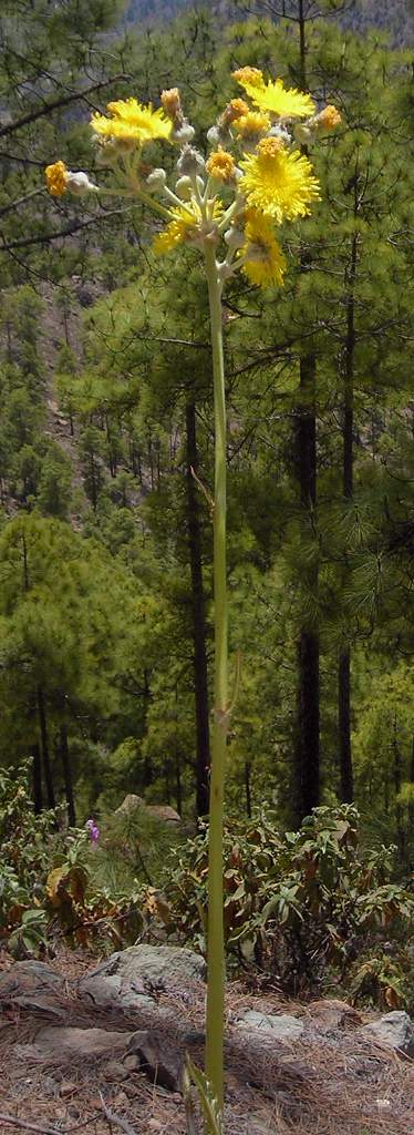 |
| Pink cistus bush. This pink cistus is widespread on the hillsides around here. There are other cistus species as well, but with smaller, less showy flowers. | 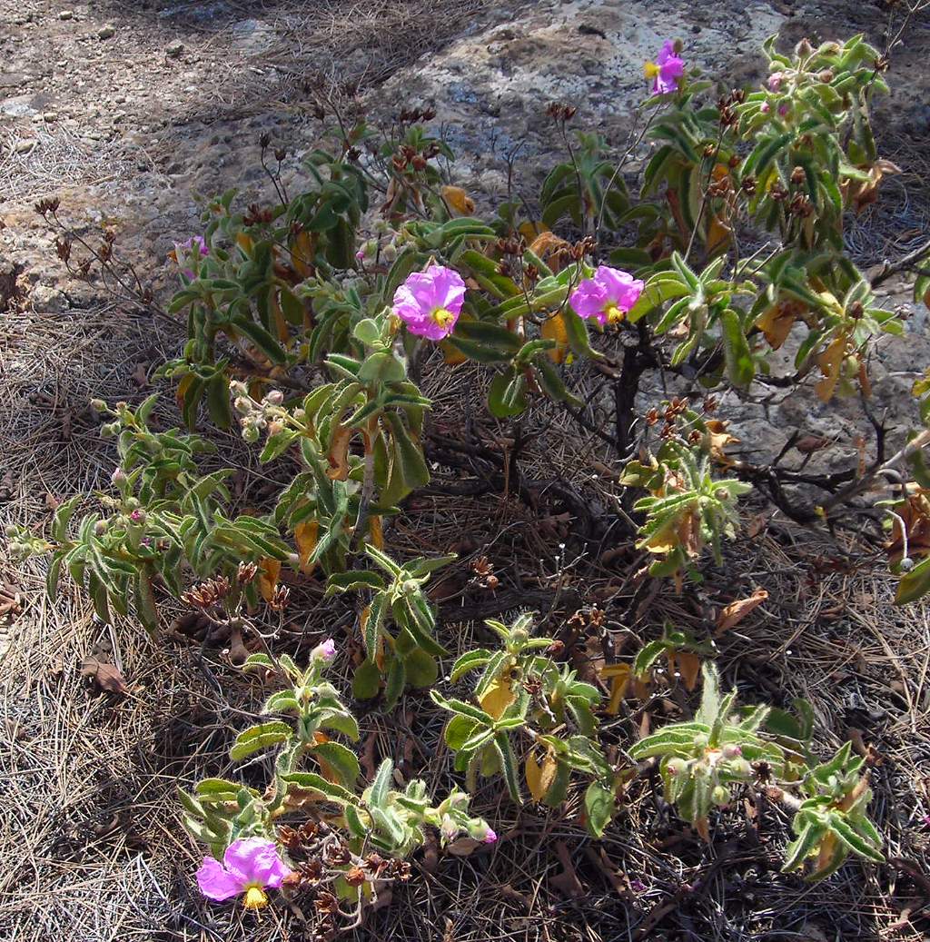 |
| Pink cistus flower. Detail of the flower, which was like crushed silk | 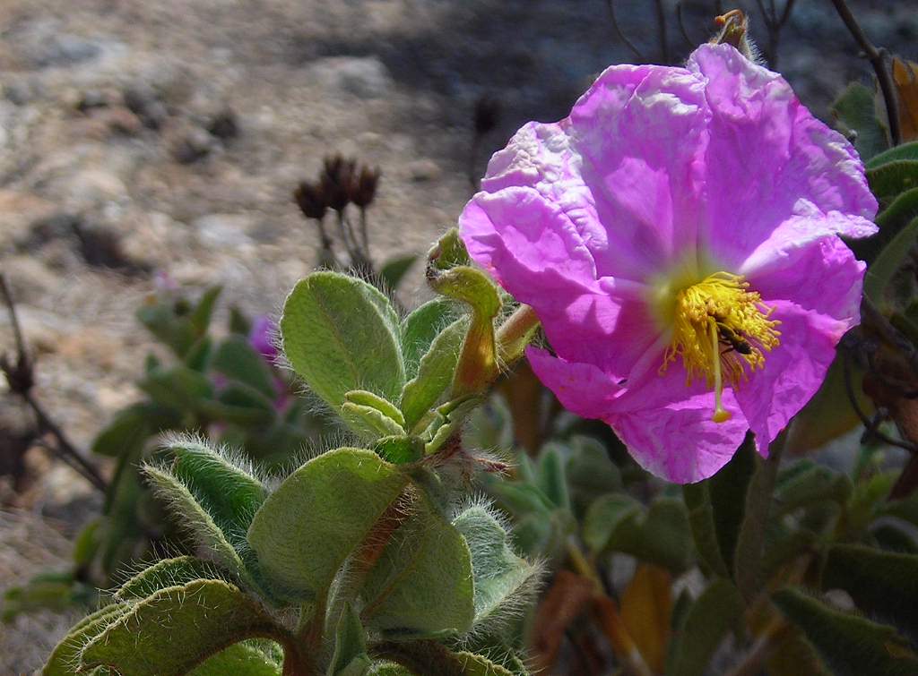 |
| Pink stonecrop. A large stonecrop up to four foot or so high. | 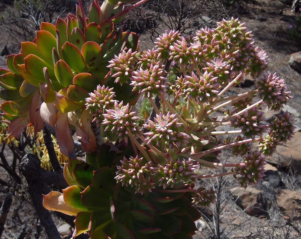 |
| San Bartolome forest. I think these forests have been replanted: certainly there are few if any very old trees. | 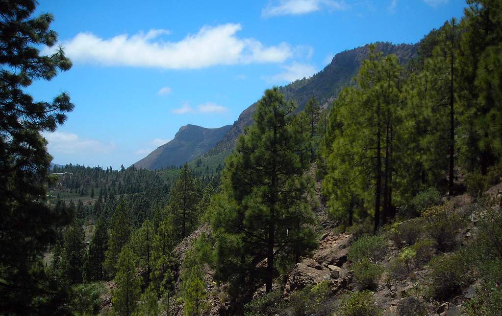 |
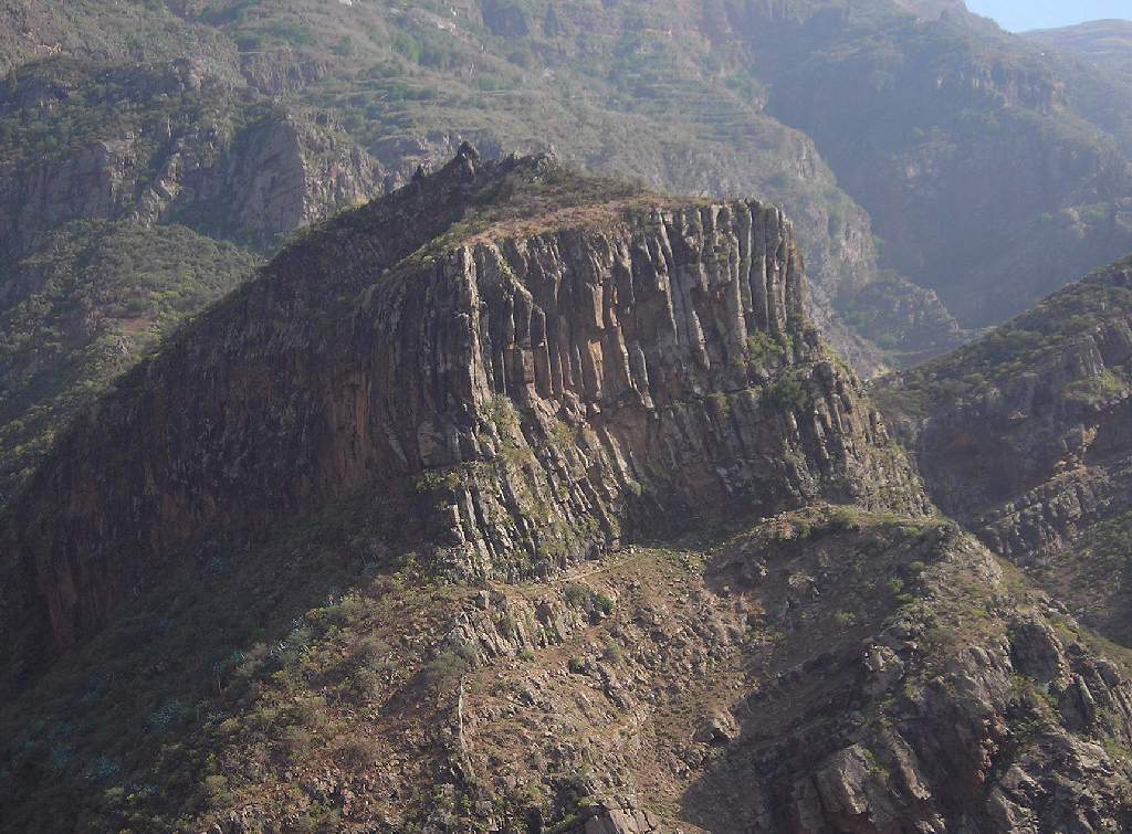
| San Bartolome mountain. A typical view, with the many lave flows showing as horizotal bands in the steep mountainside. | 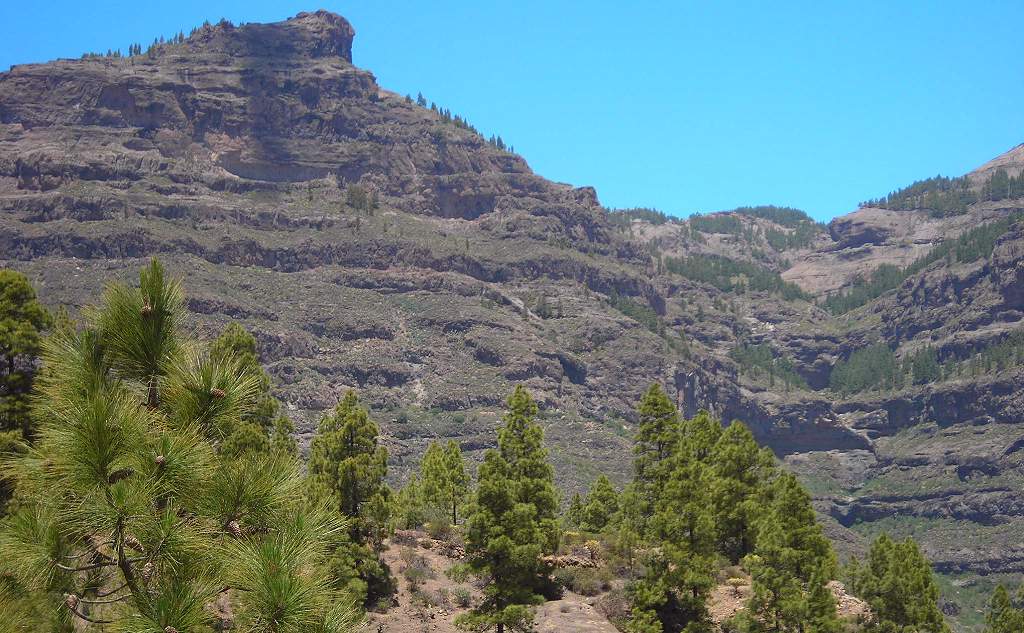 |
| San Bartolome prospect. | 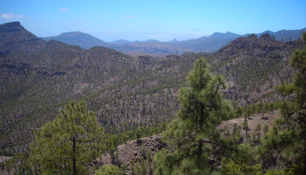 |
| San Bartolome cliffs. Bare, rather forbidding volcanic rock. | 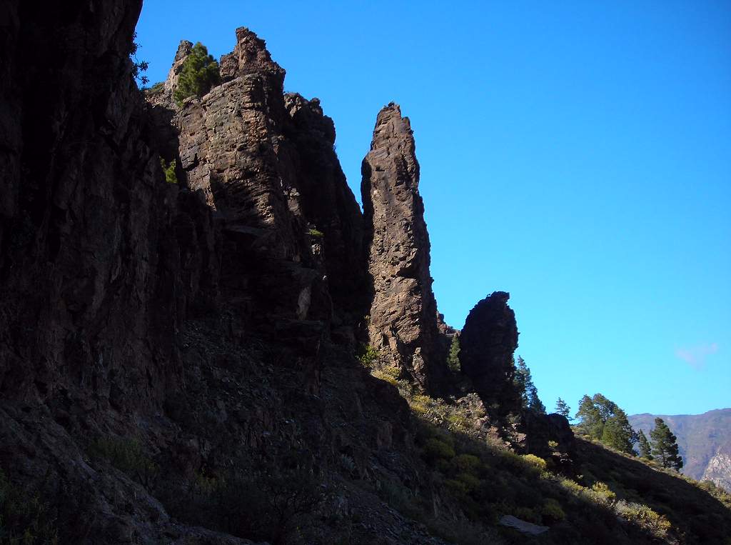 |
| Yellow peaflower bush. This was very common and is, I think, a Canary endemic. | 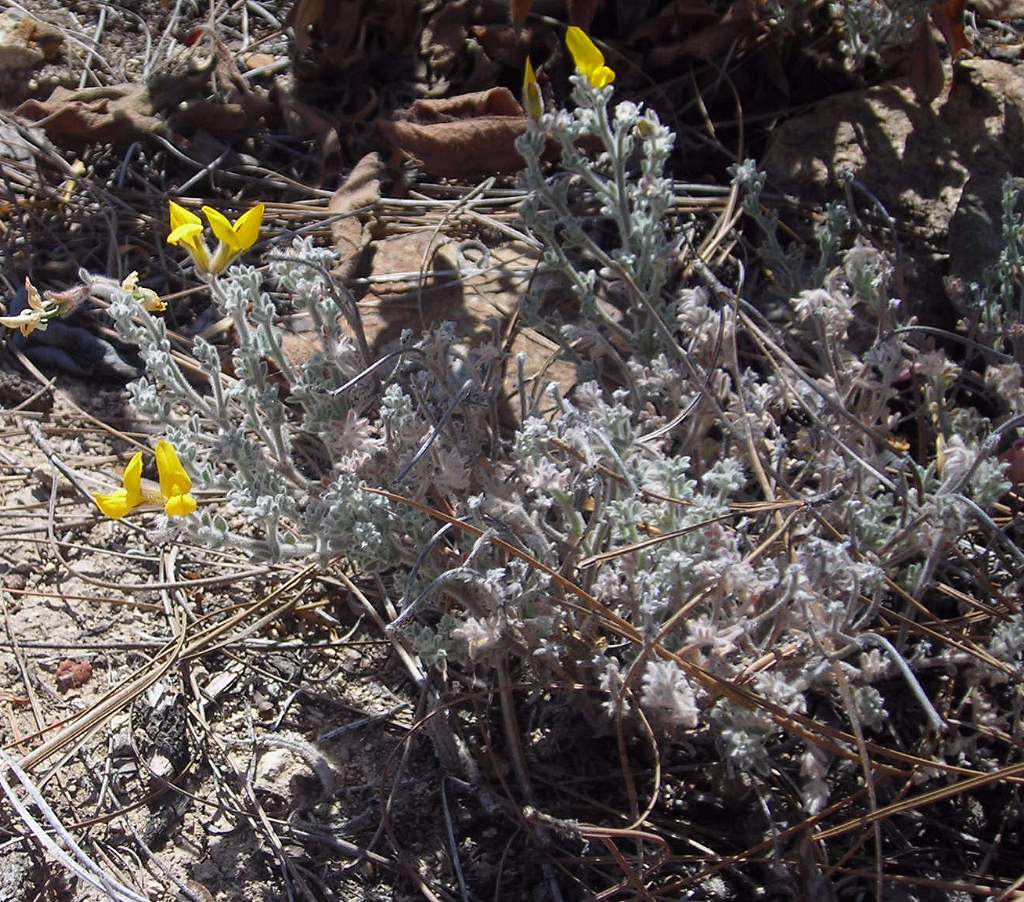 |
| Yellow stonecrop. | 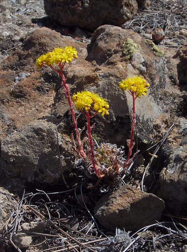 |
This was probably the best day we had for weather, with clear air that allowed us to see across to the peak of El Teide on La Palma, a good 70 miles away. The walk up to the Roque Nublo itself is rather touristy, but the continuation down to La Culata much less so.
| Red geranium. In the hotel gardens, after overnight rain: I couldn’t resist the water droplets on the petals | 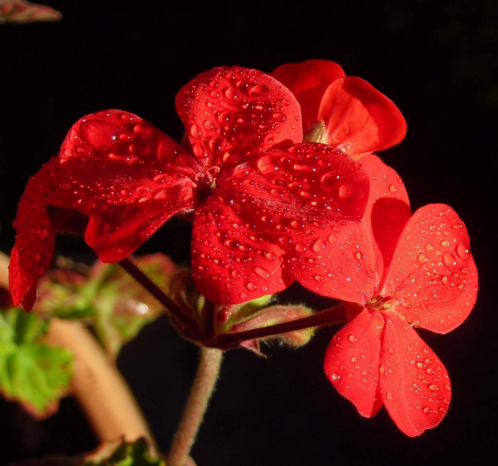 |
| Approaching Roque Nublo. A well-made, paved path leads from the car park to the Rock – one of the few honeypot tourist sites we came across. The vegetation is typical. | 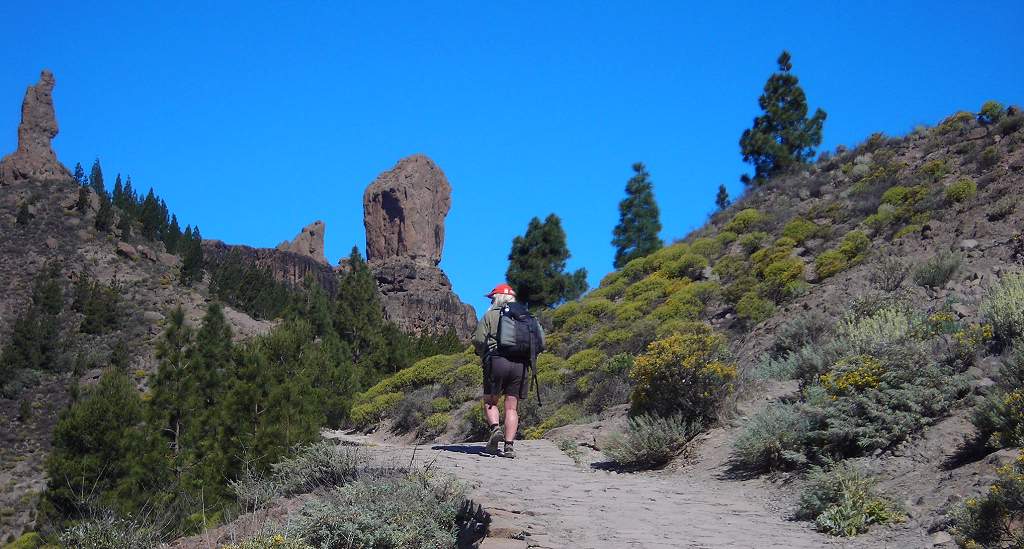 |
| Col at Roque Nublo. On the way up you reach this col, from which there re stunning views. The distanct peak to the right of the signpost is El Teide on La Palma, some 80miles away. | 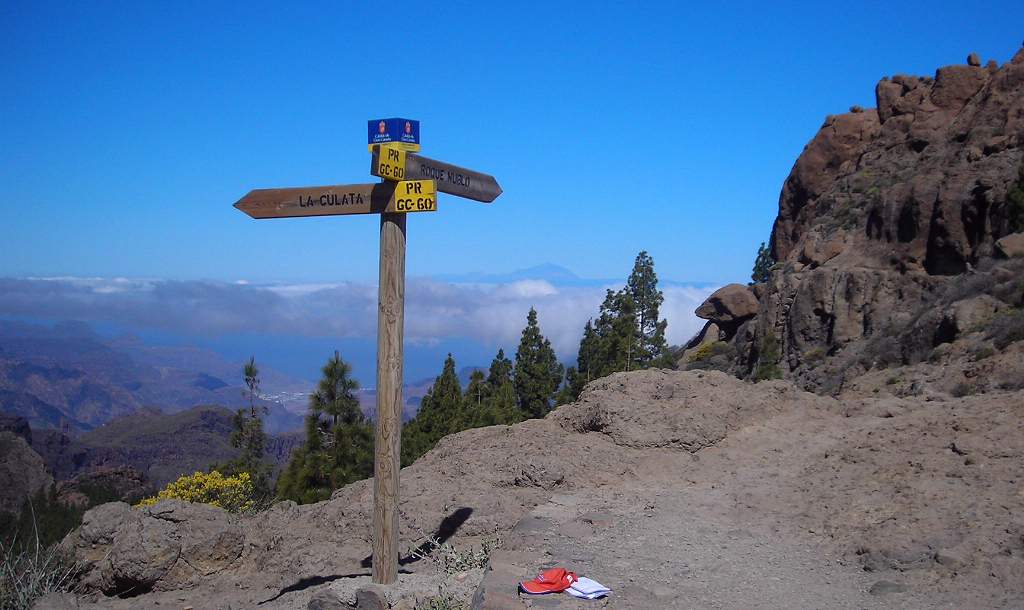 |
| View from col. | 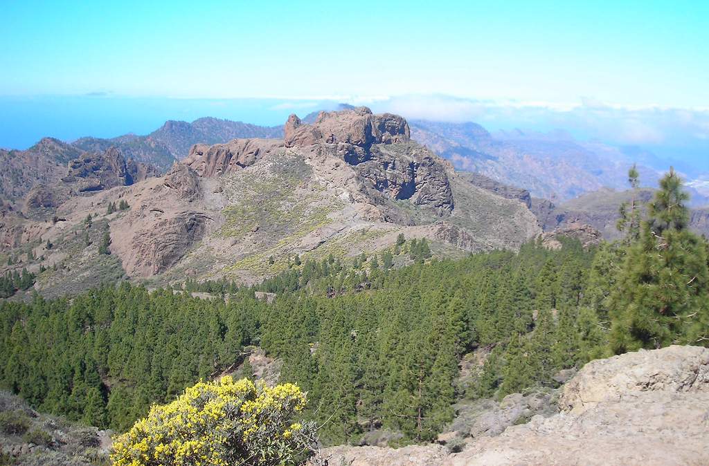 |
| Roque Nublo. The Roque Nublo along with its smaller companion rise from a bare, gently sloping rocky plateau that rises above all the surrounding peaks (which is why you can see it from so many places on the island). Until you approach closely you don’t appreciate the scale – see the figures on the left. | 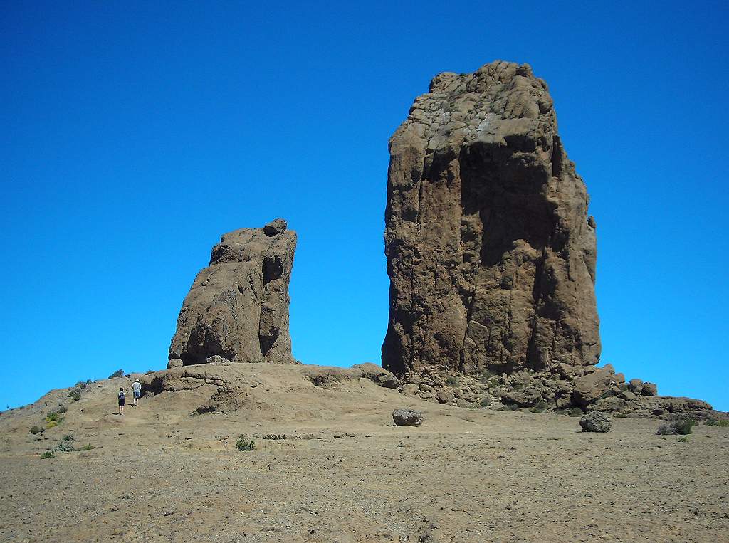 |
| El Teide. Seen from the rocky plateau. | 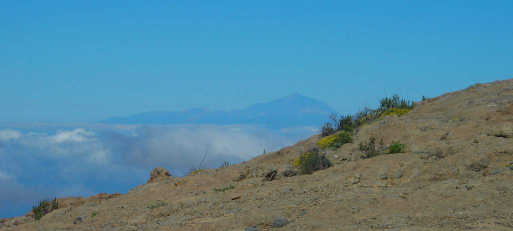 |
| View near Roque Nublo. | 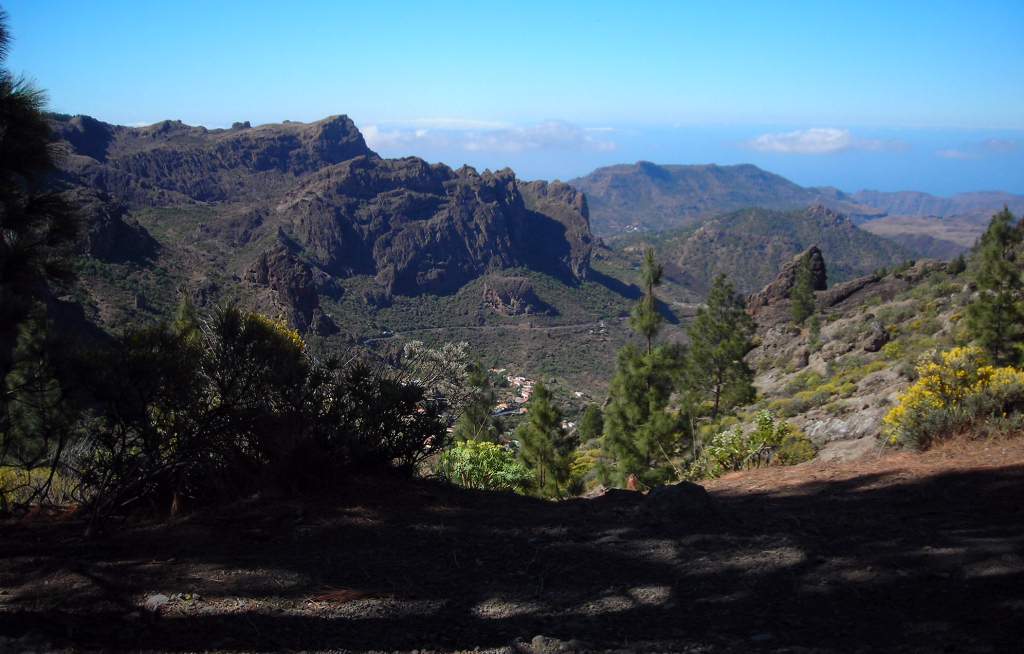 |
| Giant buttercups. The splendid buttercups, about three times the size of our meadow species, were growing in a shady spot under the pines. I only saw them in one or two spots. | 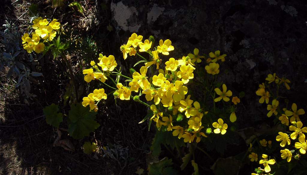 |
| Way down from Roque Nublo. | 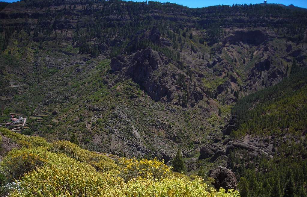 |
| Path down from Roque Nublo. | 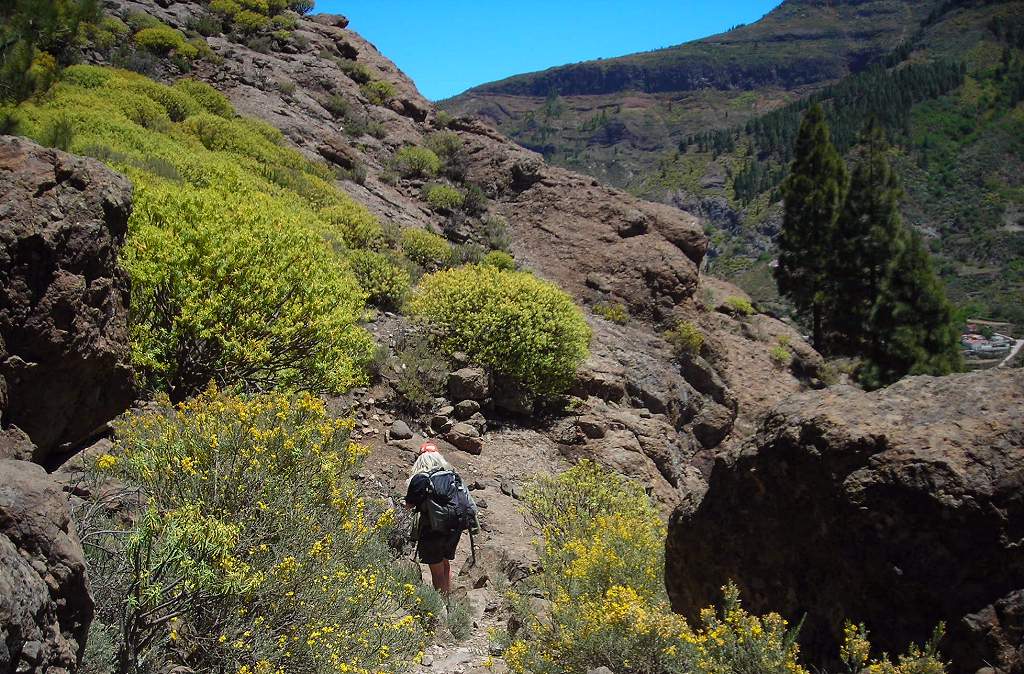 |
| Rock finger on way down. Another of the extraordinary rock formations in this area. | 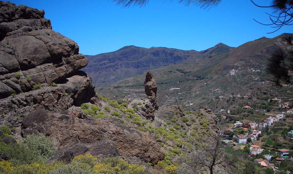 |
| View across to La Culata. This village would be an alternative starting point for a circuit round the Roque Nublo. | 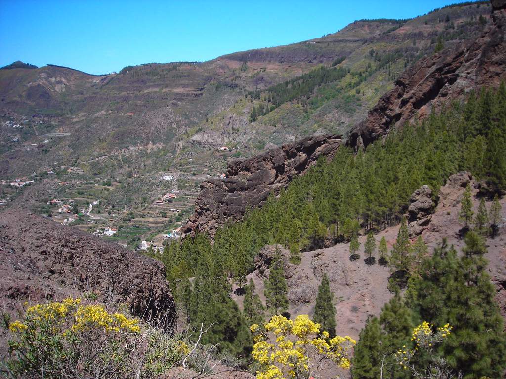 |
| Way down from Roque Nublo. Looking across to the terraced fields above La Culata. | 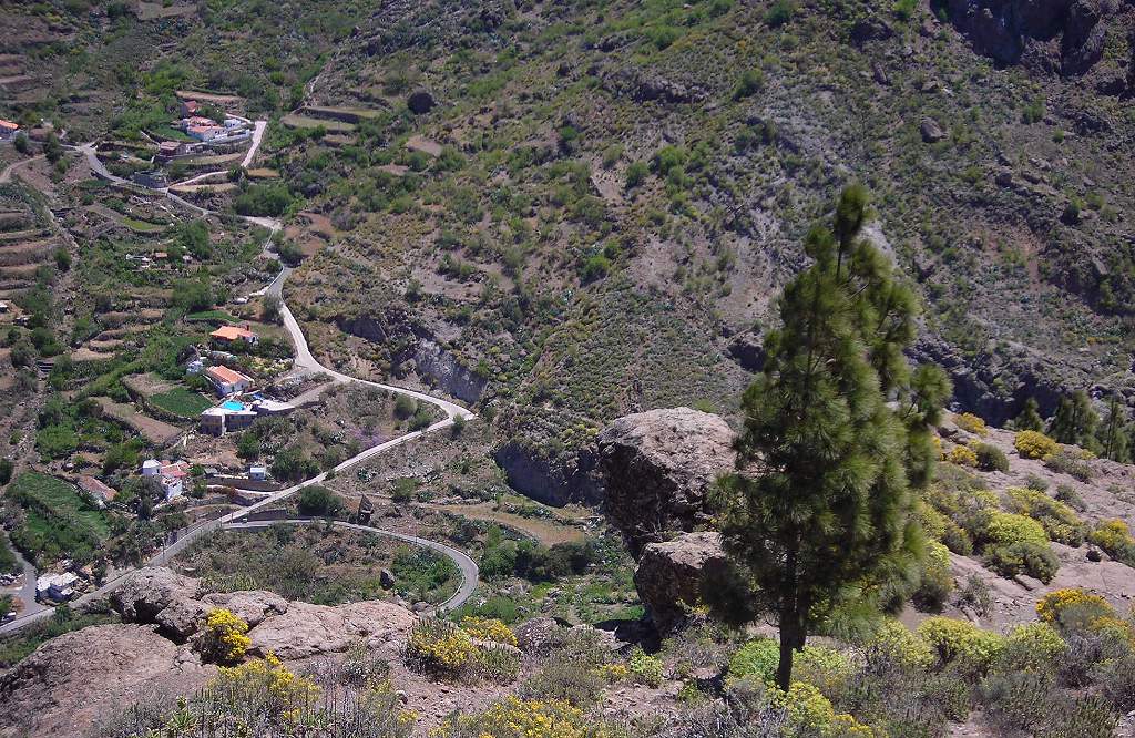 |
| Cactus nursery. Near La Culata we noticed this nursery for prickly “football cactus”, presumably being grown for the pot-plant trade. | 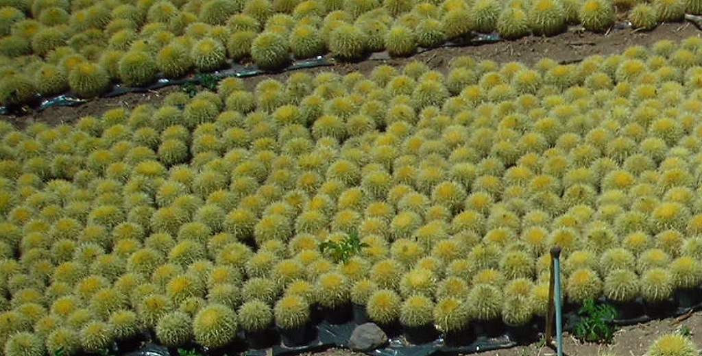 |
| Las Calas Hotel. Back at the hotel... | 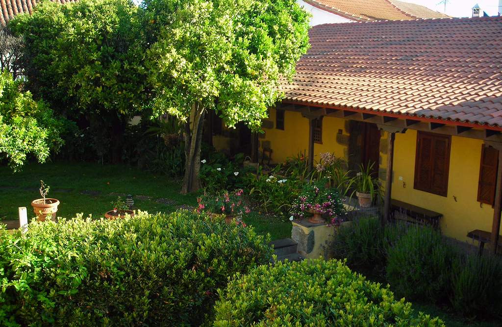 |
| Orange blossom....the scent from the orange trees was delightful. | 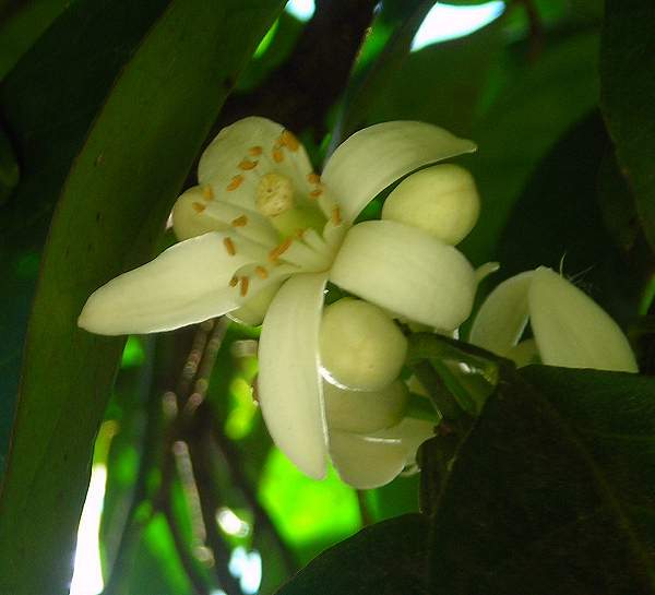 |
We spent a day exploring the central and southern parts of the island. The driving through the mountains is spectacular, but progress is very slow – you do well to average 30kph on the narrow mountain roads. The south coast is to my mind horrible, with huge tourist resort developments, which sadly encroach right onto the area of coastal sand dunes (which are themselves protected, thank goodness).
As you go south from the central mountain core the landscape changes, becoming much browner and drier, with stark rock formations and little vegetation, apart from oasis-like palm groves. Many of the valleys are cut into deep canyons or barrancos. This would not I fancy be good walking country: too steep and rocky, and hot with little or no shade.
| Kangoo. Not my usual choice of transport! This is what you get as a Group A hire car from the airport – actually the high driving position and big windscreen were good on the country roads, though a bit more power would have been welcome on the climbs. And it was frugal. | 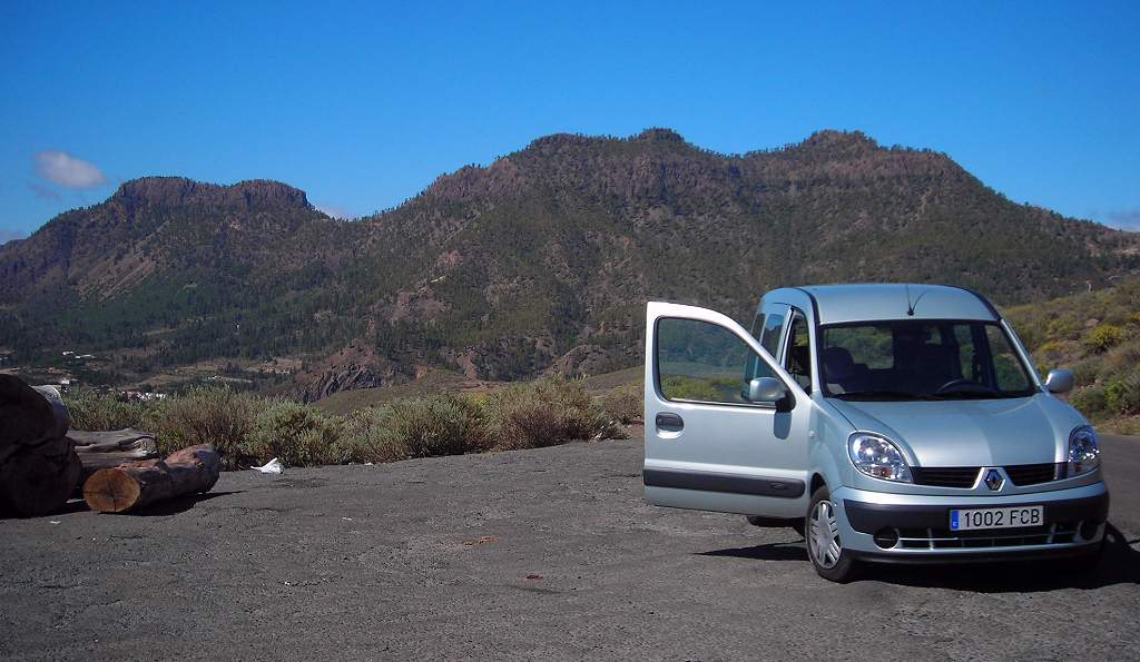 |
| Southern landscape. Looking back at the mountains. | 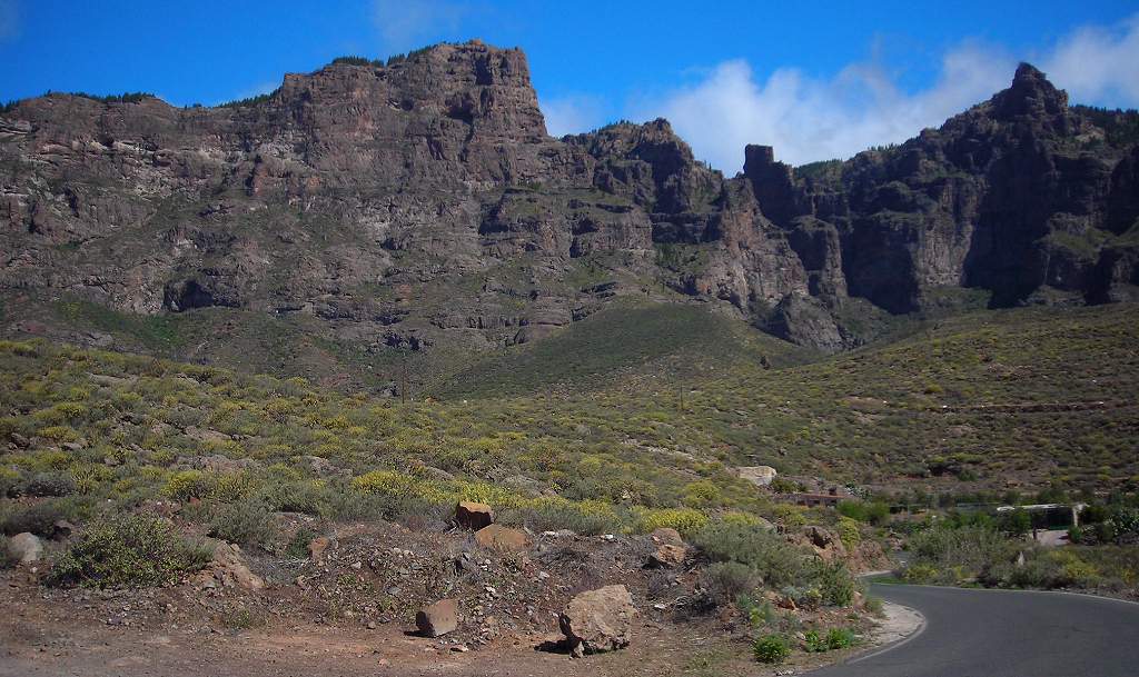 |
| White village. | 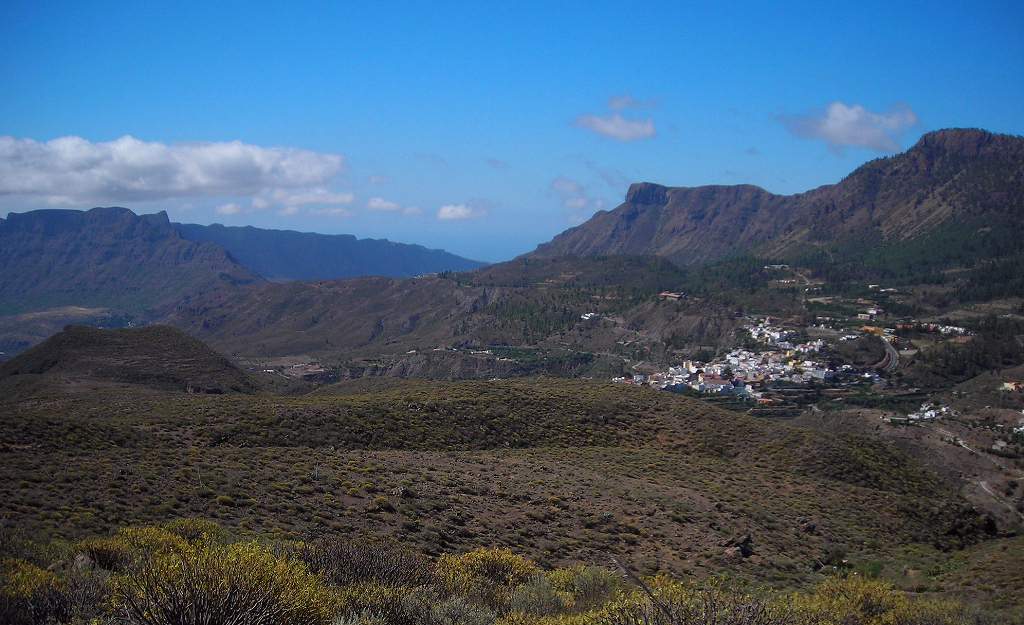 |
| Santa Lucia statue. Santa Lucia is an attractive small town in the southern foothills. This bronze statue stands in the square where there is a also a water feature with a small artificial waterfall. The sound of running water is very welcome in such a hot climate. | 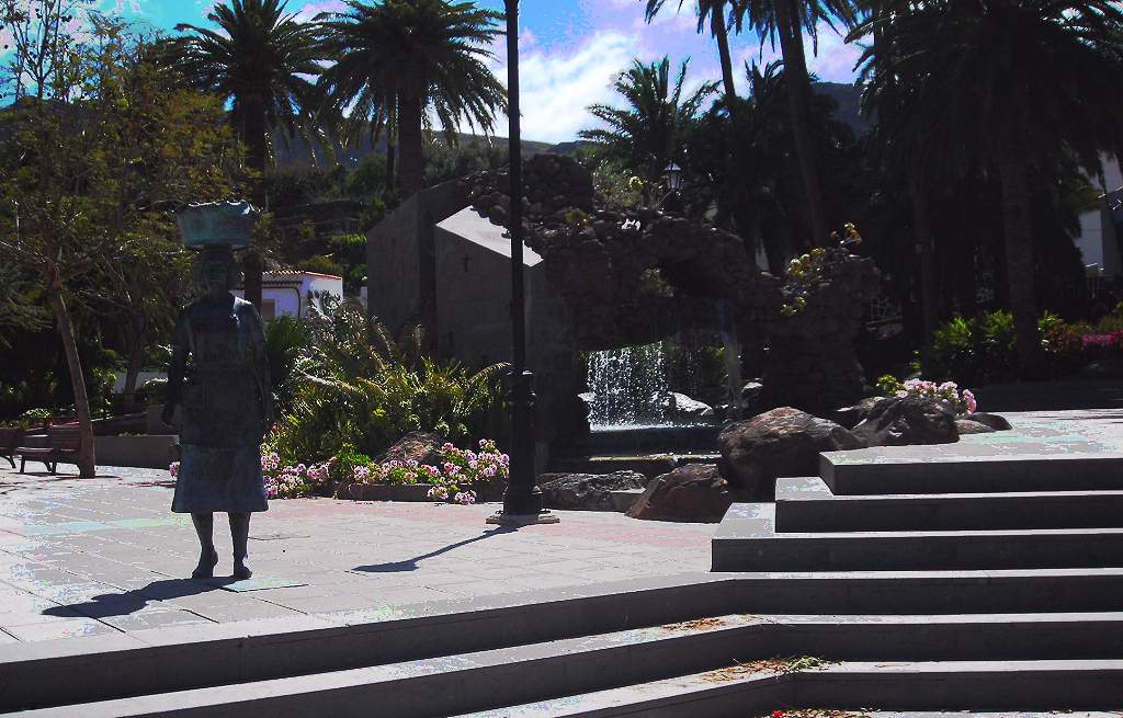 |
| Santa Lucia church. Overlooking the square. | 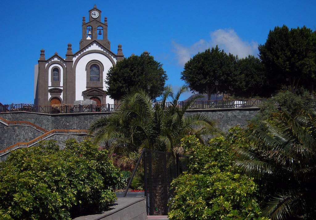 |
| Santa Lucia. Another view from the square. | 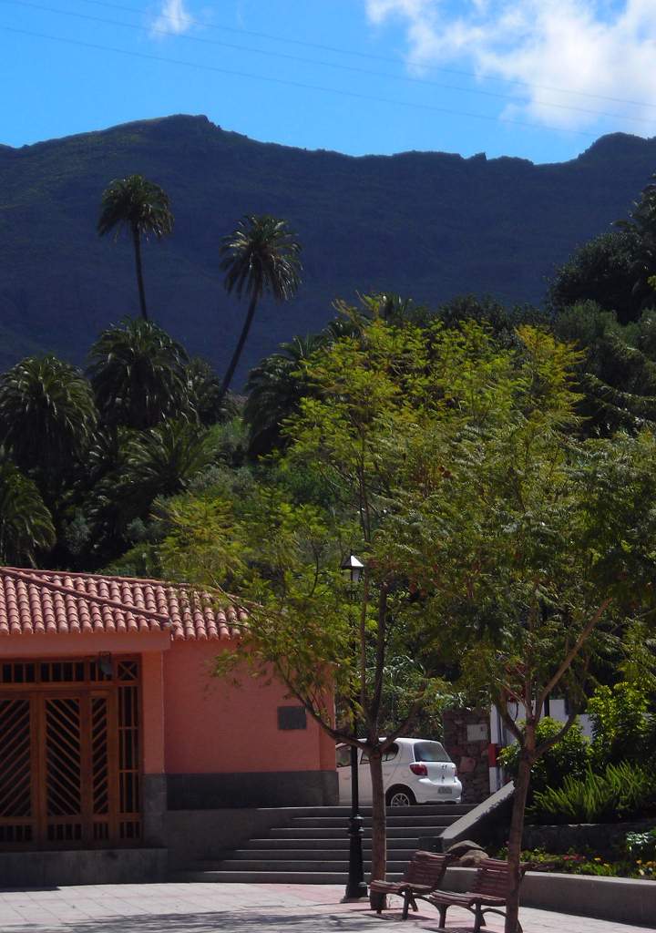 |
| Wild Olive flowers. Growing by the roadside. | 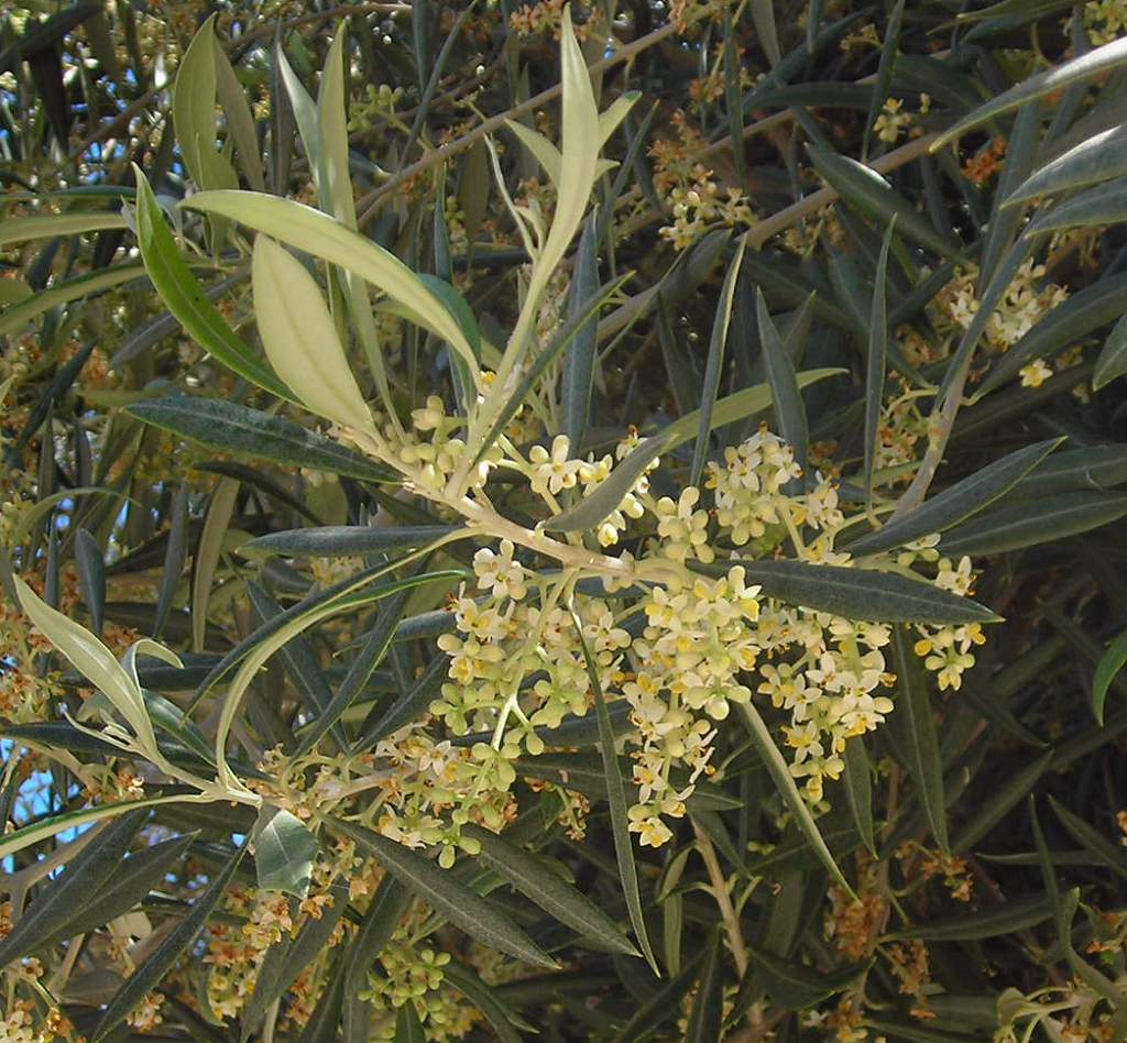 |
| Canary Sage. Also by the roadside. This is an endemic plant, much larger than our sage and with a different scent. It is common on the rocky slopes. | 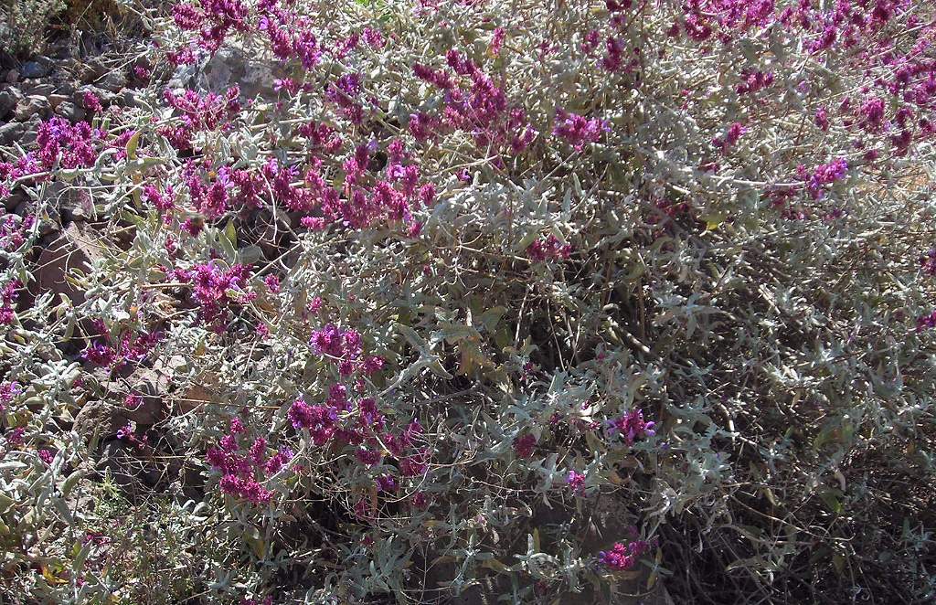 |
| La Sorrueda reservoir. The water level was quite low in this reservoir, but it is still an attractive feature in the otherwise almost desert-like landscape. The palms round here are some of the few remaining native palms in their original groves. | 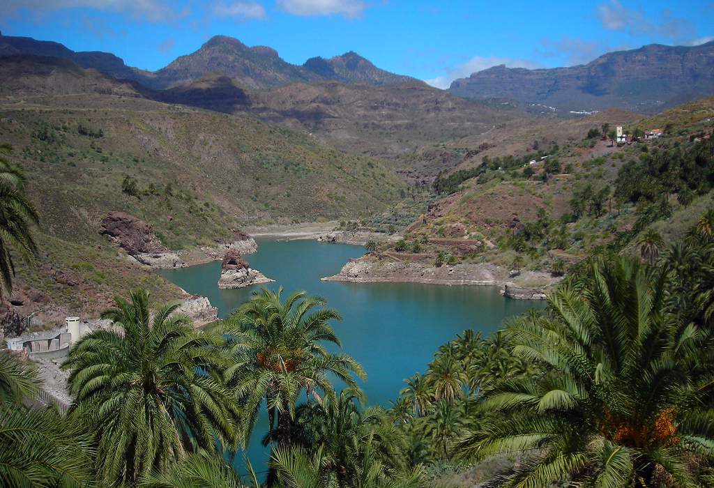 |
| La Sorrueda palms. | 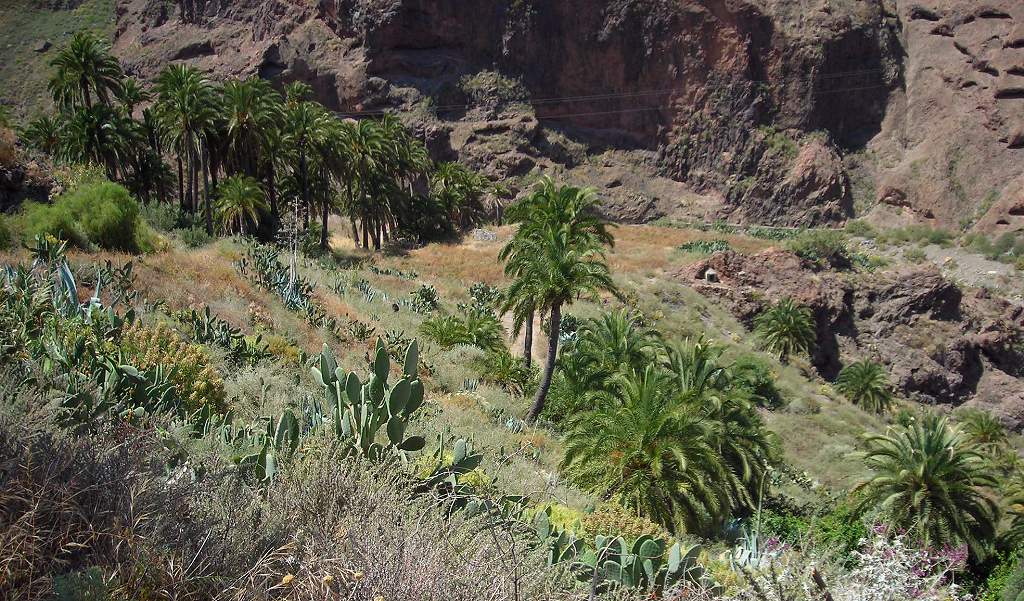 |
| Palm grove. A closer view of the endemic Canary palm. | 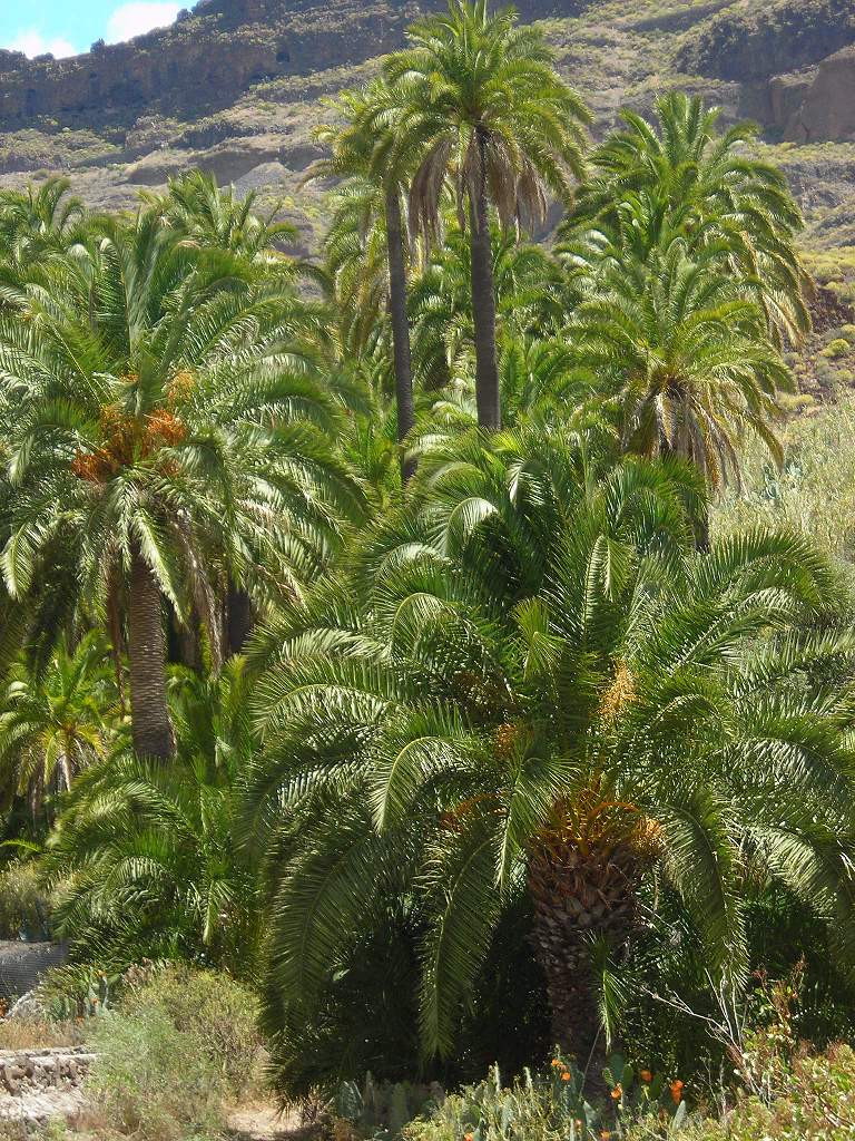 |
| Guriete Mirador. A view down one of the deep canyons. This part of the island reminded me of pictures of the American west. | 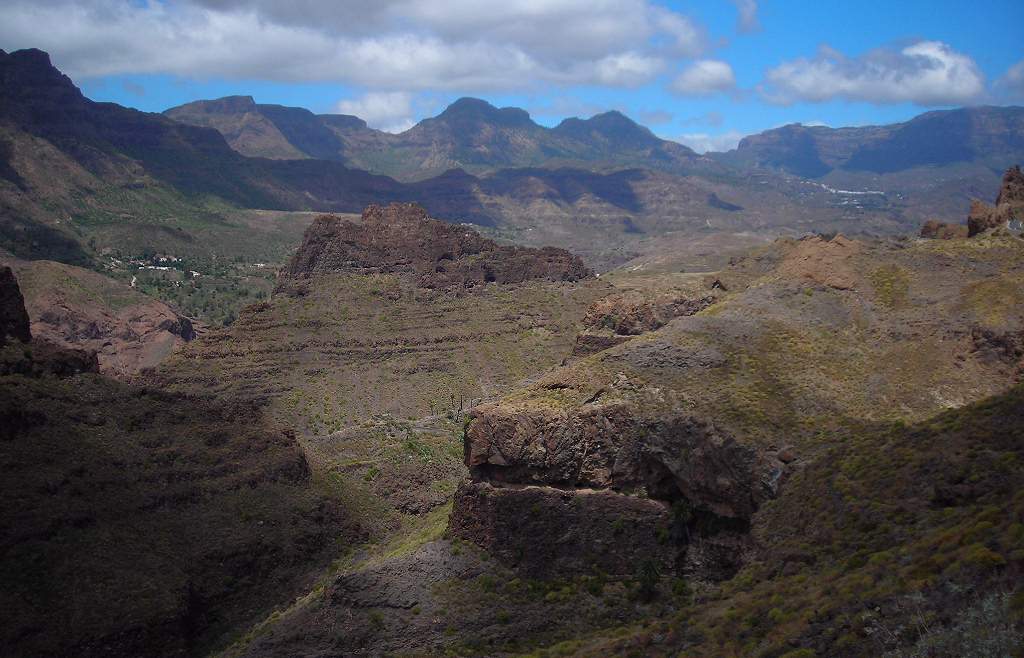 |
| Restaurant courtyard. A very pleasant courtyard in a village restaurant (rather unexpected as you enter from the road through the door you can see in the background through the indoor dining room). The salad was good too. | 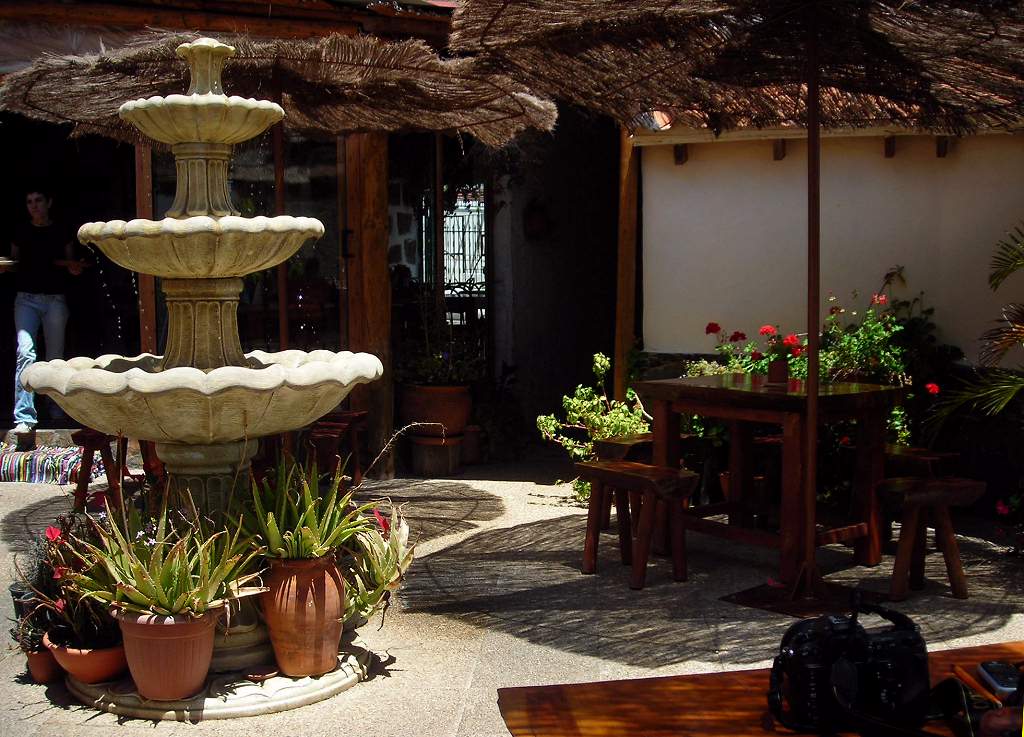 |
| Green hills near San Mateo. Returning to the north, and the contrast is amazing. Lush farmland and much greener hills, near San Mateo. You can see the cloud / mist lapping over the slopes; most days we drove down this road you could not see the view at all. | 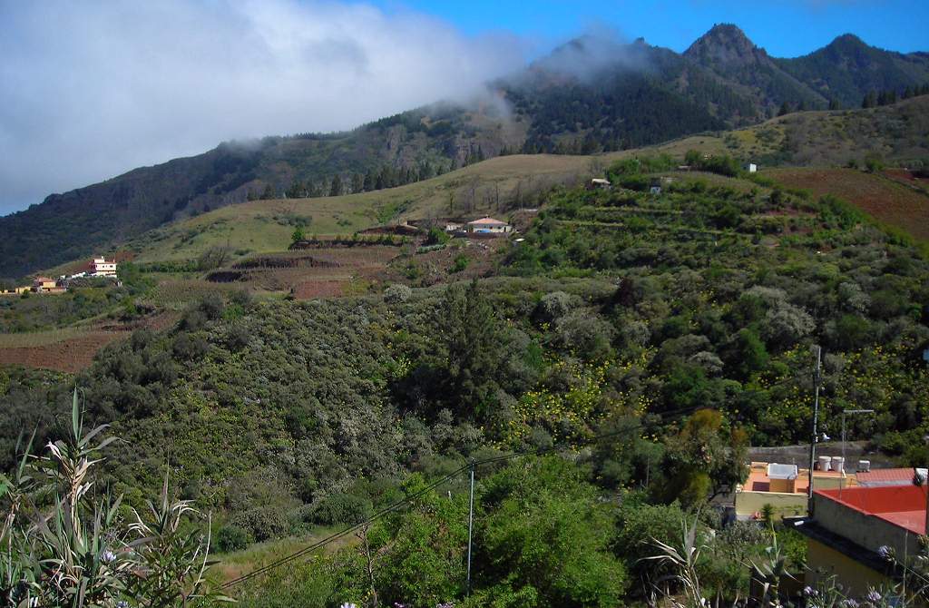 |
| Eucalypts on roadside. Just a little further down the road, as one approaches San Mateo, the road is lined with these huge eucalypts. The non-native trees have been widely planted in this area. | 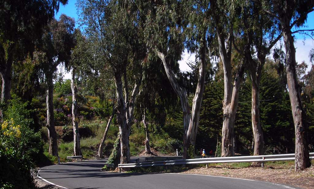 |